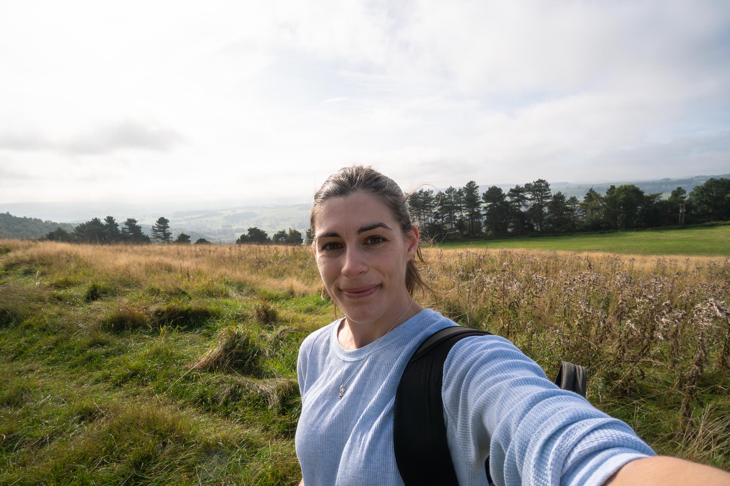
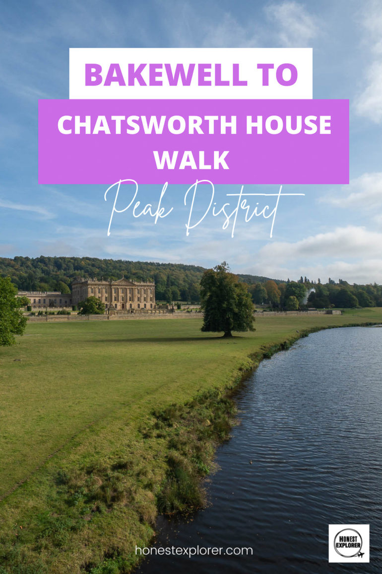
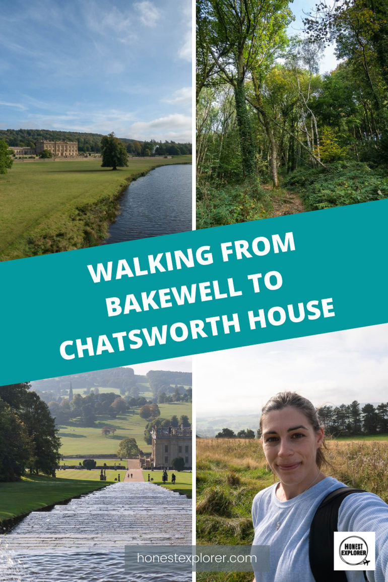
If you are exploring the Peak District, then the cute village of Bakewell and the stunning stately home of Chatsworth House should be at the top of your list! I visited in Autumn and the gardens of Chatsworth were just spectacular!
Whilst you can get a bus from Bakewell village, the walk to Chatsworth was just as pretty as the place itself so I would thoroughly recommend! You will walk through woodlands, fields, and a pretty village!
Gardens of Chatsworth House.
I would recommend getting to Bakewell early in the morning, to give yourself time to explore the village before the walk. It took me well over an hour to do this walk, maybe even 2 hours, I forgot to track time- oops! I did get a little lost in places though!
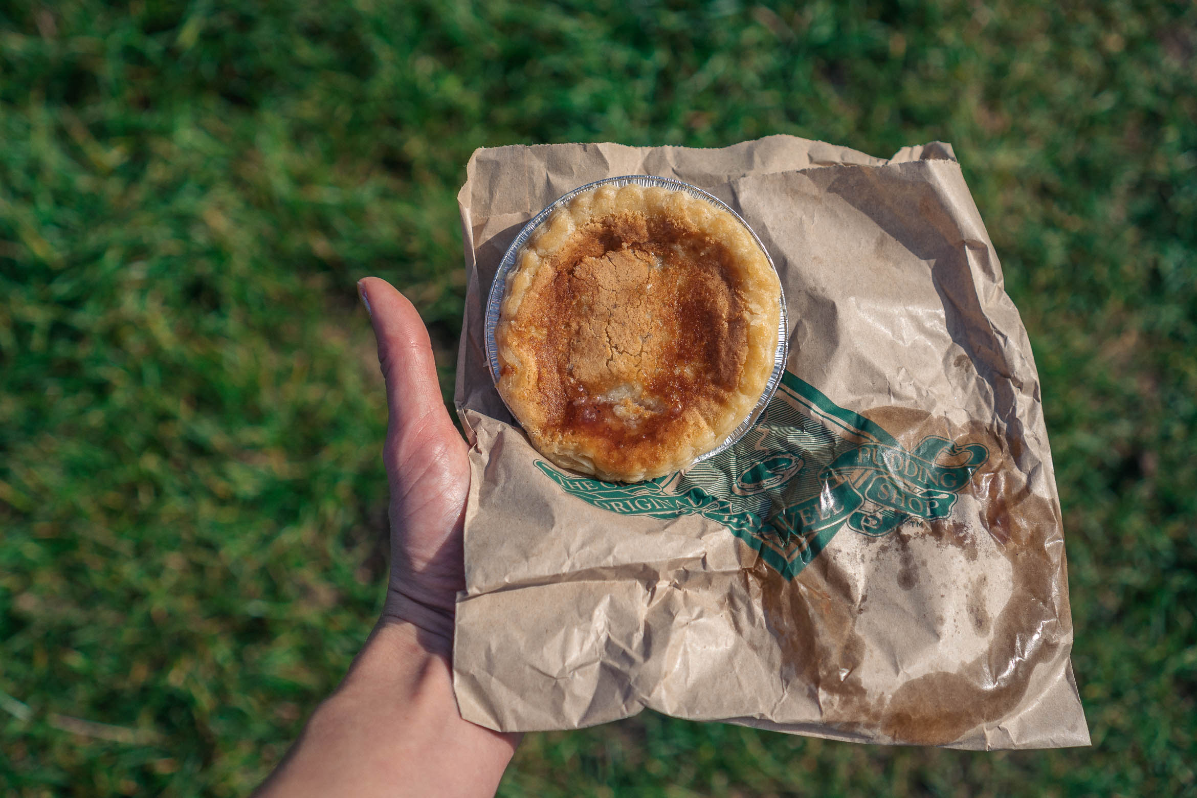
Remember that Chatsworth House can take a while to look around, even if only visiting the gardens so allow a minimum of 2.5 hours here, 3 hours even better so you are not rushing! Also, a little tip, pick yourself a Bakewell pudding up from one of the bakeries in Bakewell. It makes a great snack for your walk!
Bakewell village is the home to the Bakewell pudding, a delicious English dessert which was apparently made by accident when a chef mixed up two recipes together! The Bakewell tart came after, both are delicious!
Let’s start the Bakewell to Chatsworth House Walk…
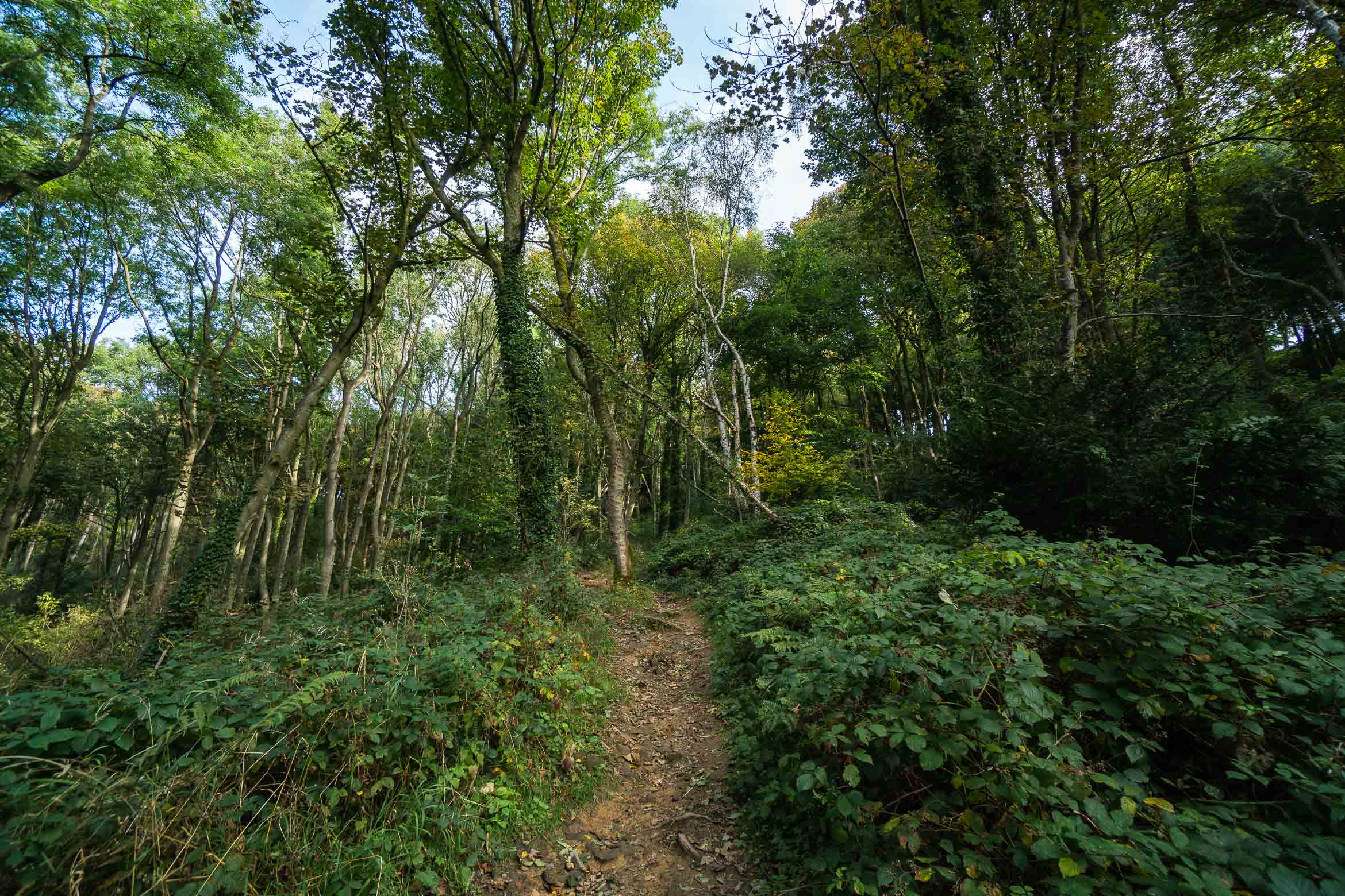
Turning right from the Bakewell visitor centre, along Bridge Street, cross over the small Bakewell bridge and turn right onto Station Road. This will go upwards and then bend around to the left. After a while keep to the right as the road forks a bit, and then shortly after there is a small footpath veering off the road, on your right (into the trees). I missed this, so keep an eye out! If you do miss it, then just cross over the golf course on the right and you will see a path leading into the woods.
Follow the woodland path uphill.
The woodland path goes up a hill and at the time there were several little streams running down too. This is a lovely section of the walk. Keep going up this path to the top and you will come out at a small road.
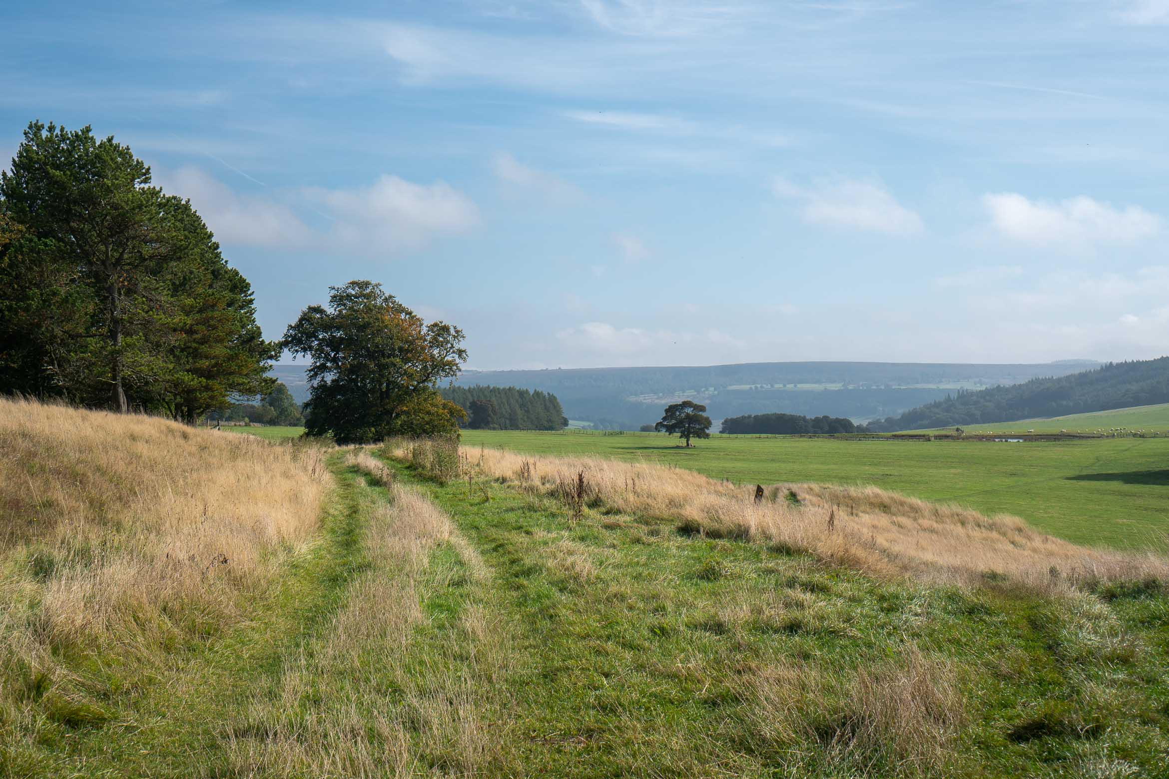
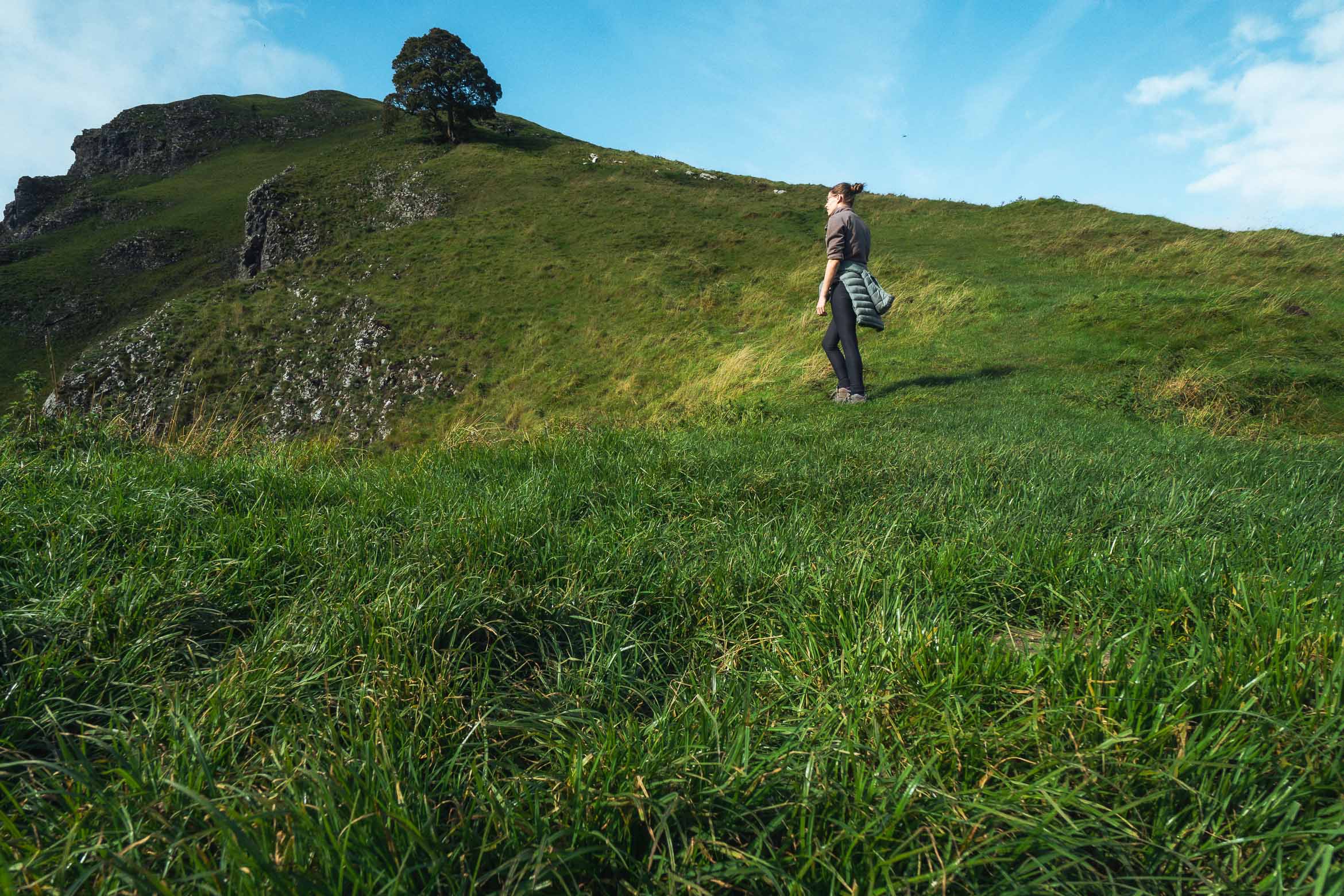
To your right, you will see a stile which leads to some fields (there is no signpost). Go over this and walk straight along the path, with views of the fields and hills to your right. Please note that this field is full of sheep shit further ahead, so bring along some hiking boots or something you don’t mind getting a little dirty!
Walk the grassy path with views of hills to your right.
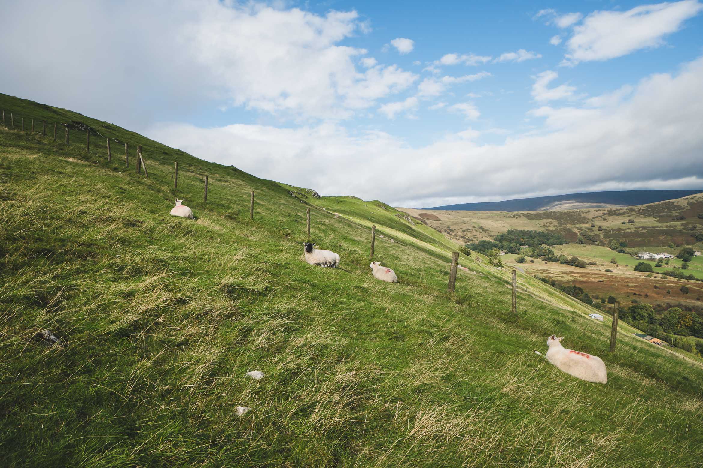
After a while you will see a small pond towards the right-hand side. There is a gate you will need to walk through on the right-hand side of the pond. After the pond, take another gate to the left and follow the grassy path gradually downhill.
To the right you can just see the pond where the sheep are. Walk through the gate on the right hand side.Take the second gate just after the pond and walk straight down this field.
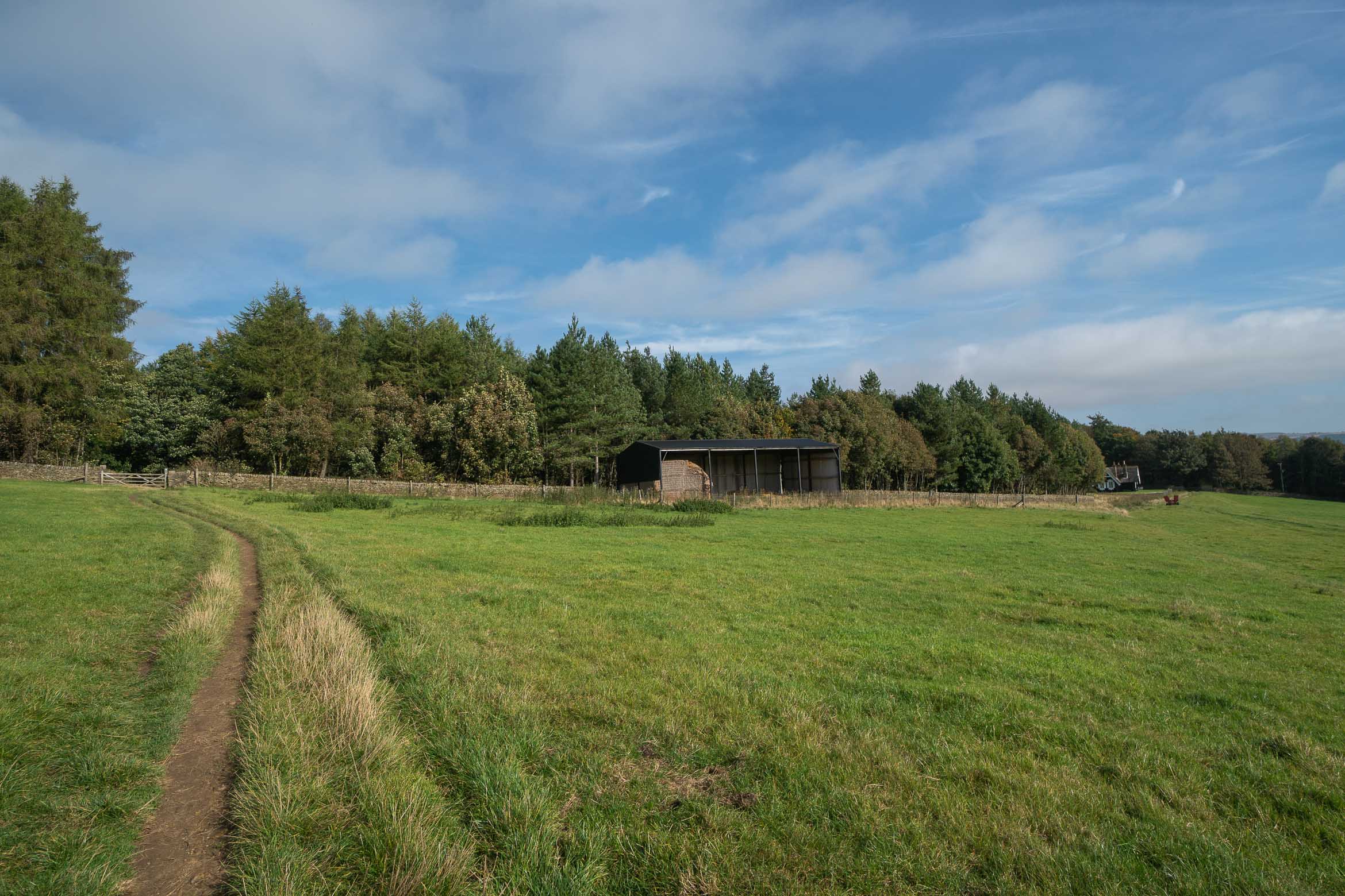
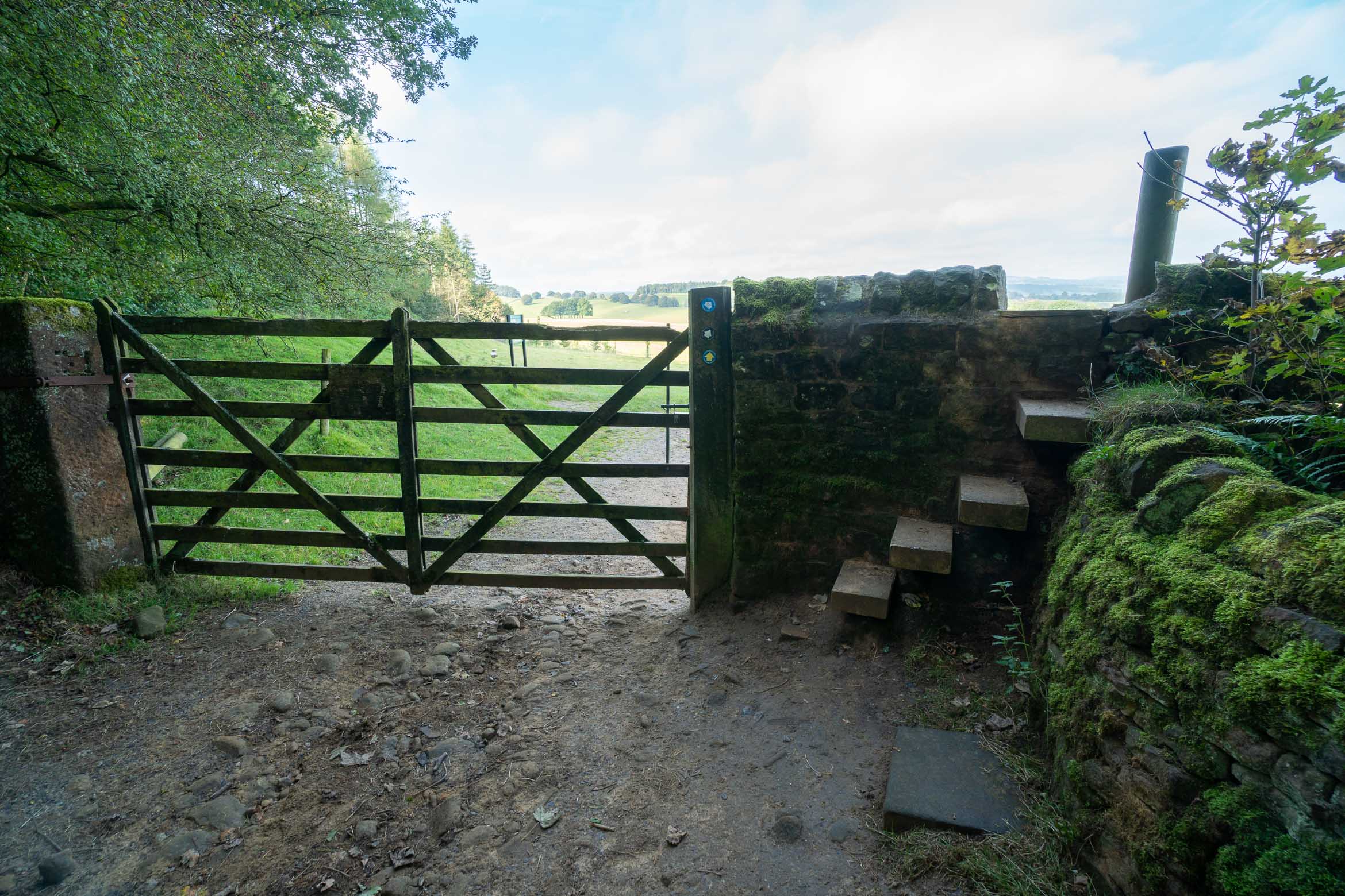
You will eventually see a small barn and a pretty house just after (this is called the Russian cottage). Follow the path you are on to the left, in front of the barn and house, and go through the wide gate. This leads downhill on a rocky path, which leads to another gate/ wall.
Take the gate on the left of the image, which leads to a wall and gate.Climb over the wall.
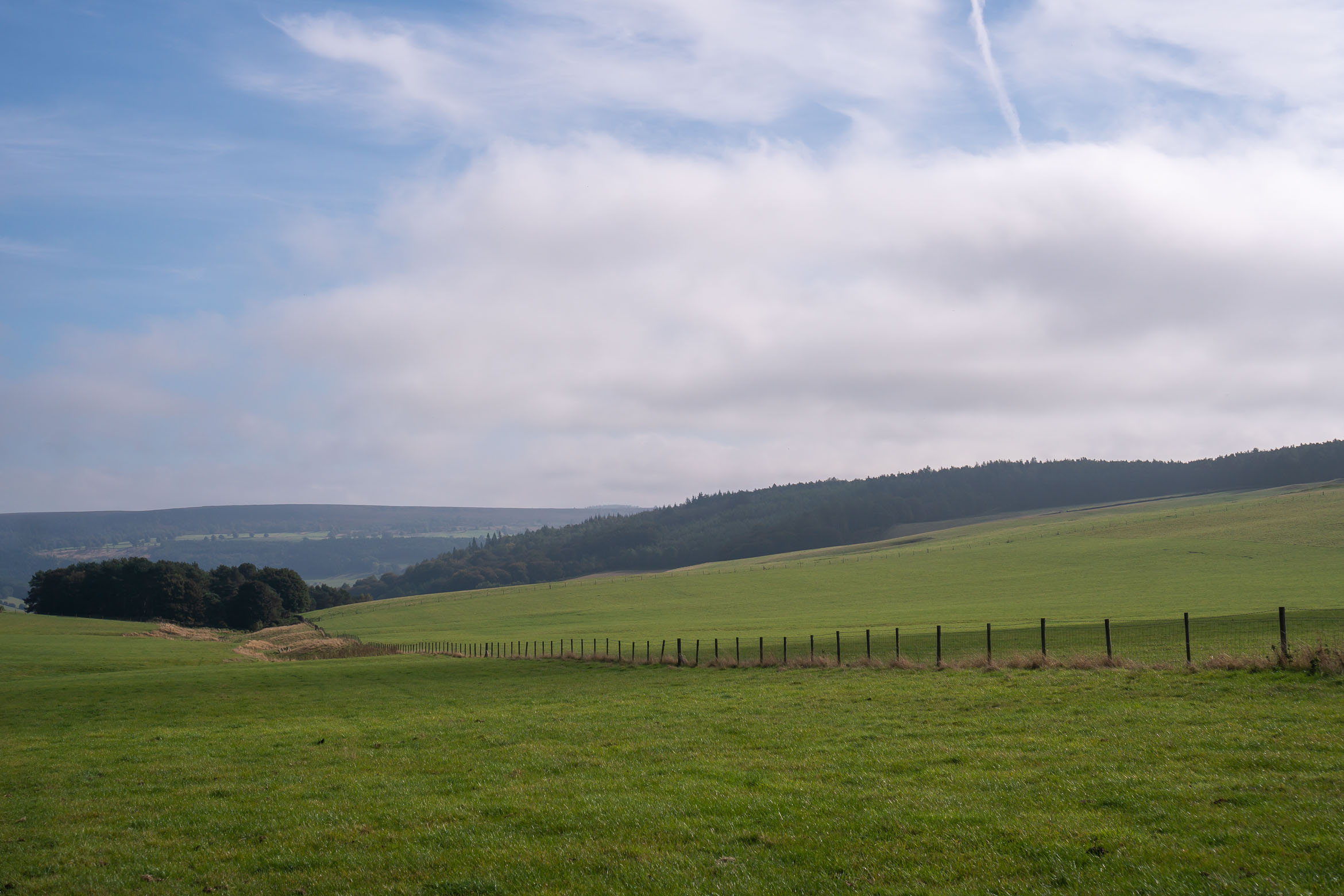
Climb the steps over the wall and take in the views over to Chatsworth House (you may not able to see it behind the trees). Here is a great place to stop for a snack and take in the views.
Time for a snack!
From here walk downward through the middle of the trees and grass land and towards the church tower of Edensor (it will come into view). Chatsworth House from a distance should come into view but walk towards the left of the field and slightly away from the house.
The path is a bit unclear but head in the middle of the tree line.
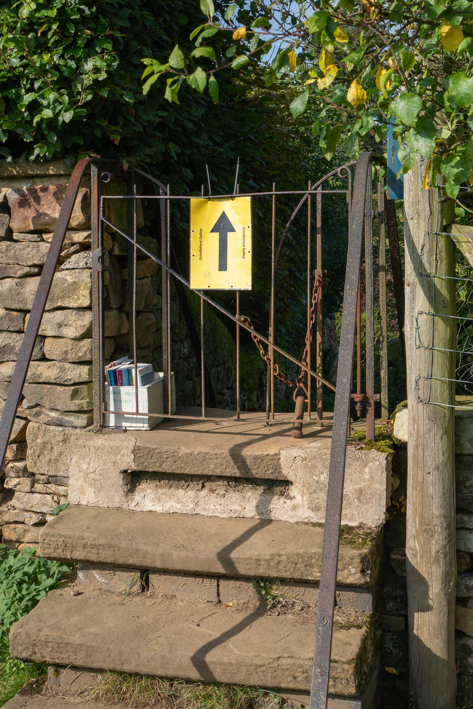
In the lower-left corner of the field, you will see some houses along a stone wall, and a small iron gate. This is kind of hidden so keep an eye out.
To the far left of the field are some houses and an iron gate.The iron gate leading to Edensor village.
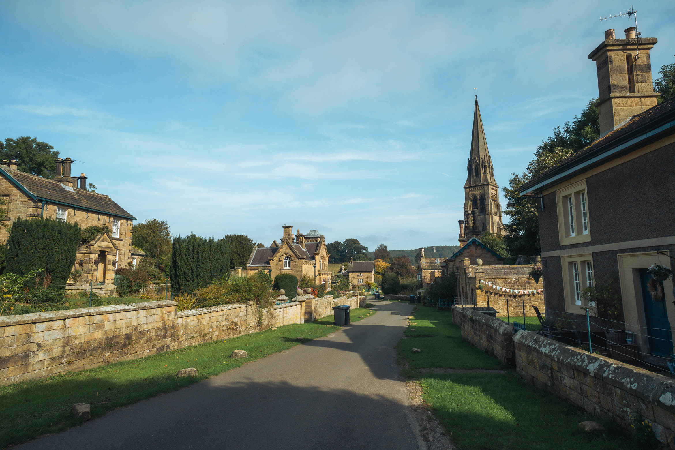
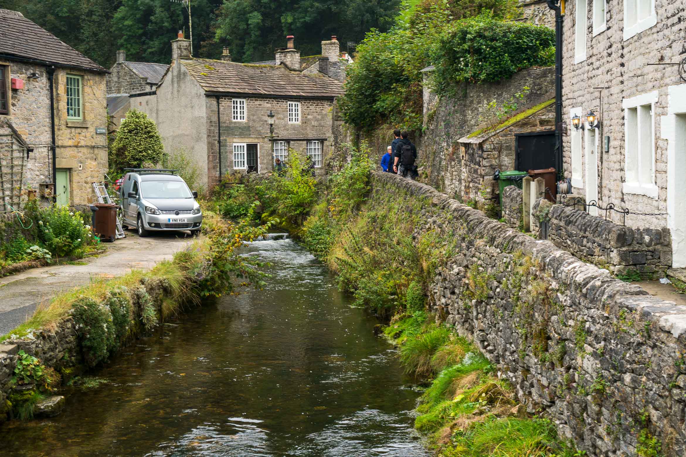
Go through the gate and you will come out at the pretty village of Edensor. Turn right, going down through the village (it’s quite small), and then straight on out through the gates and over the road.
Walk through Edensor village.
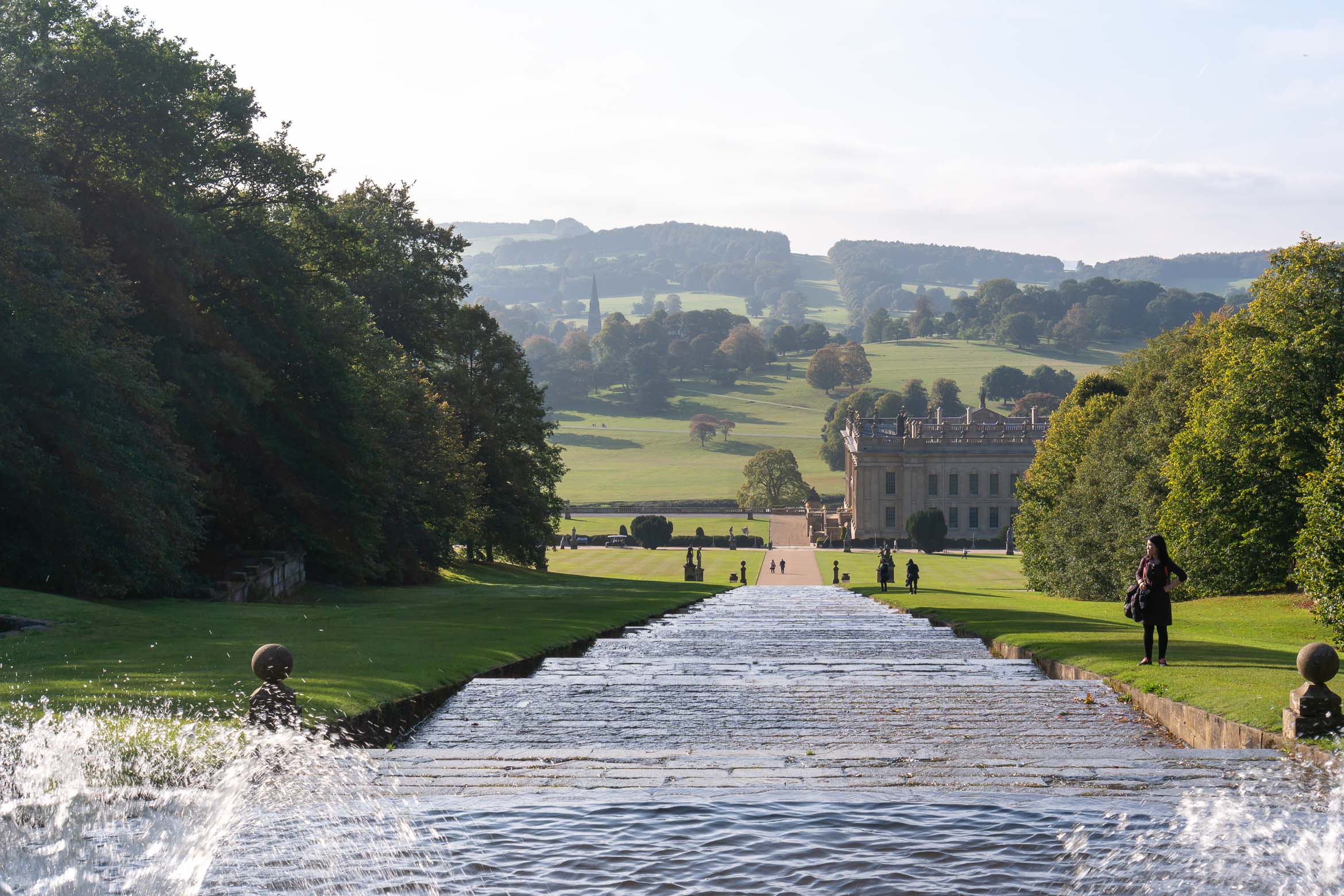
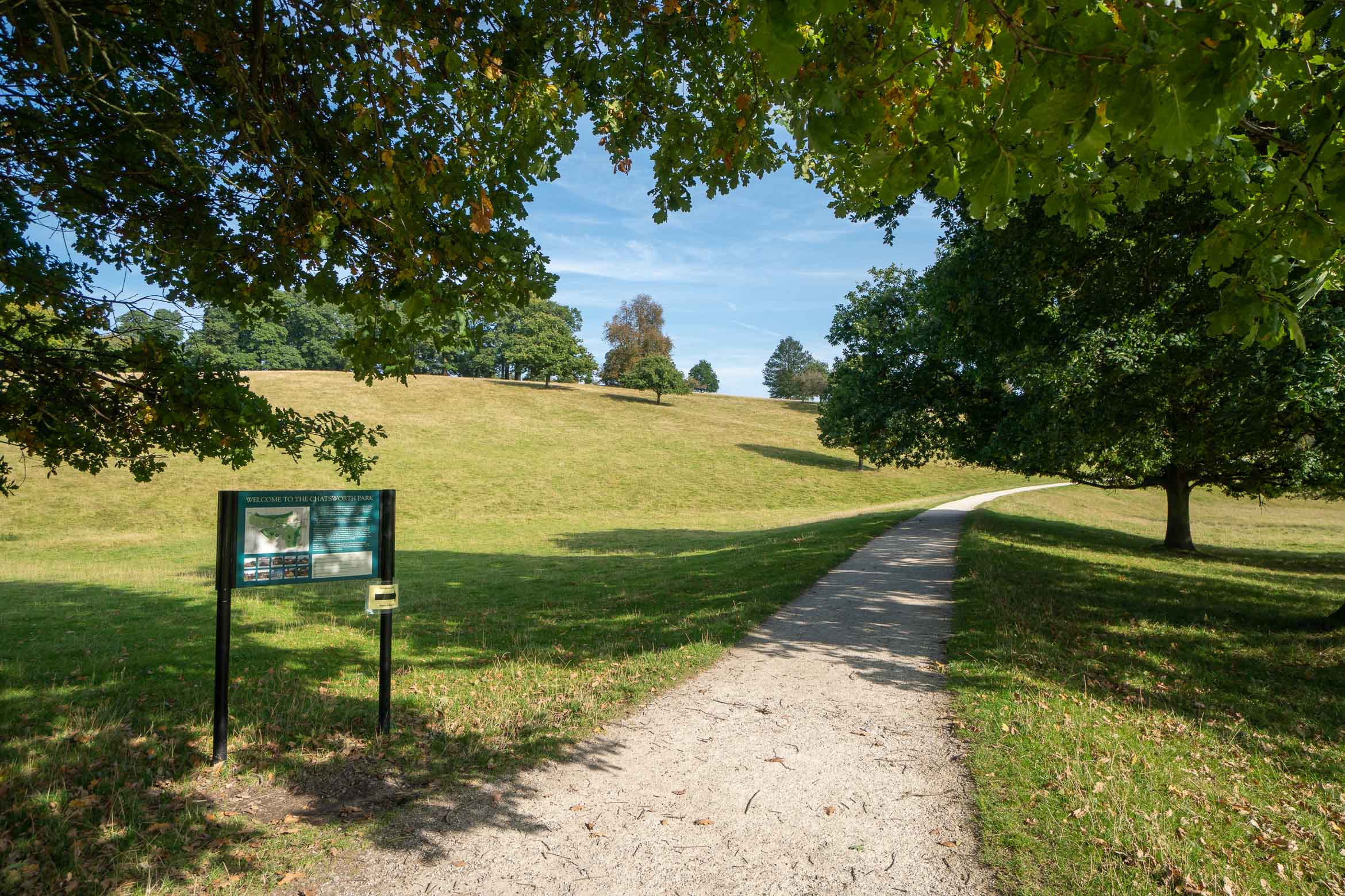
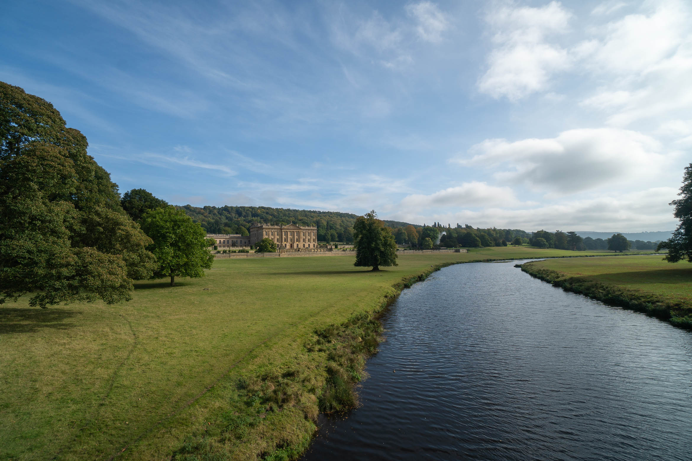
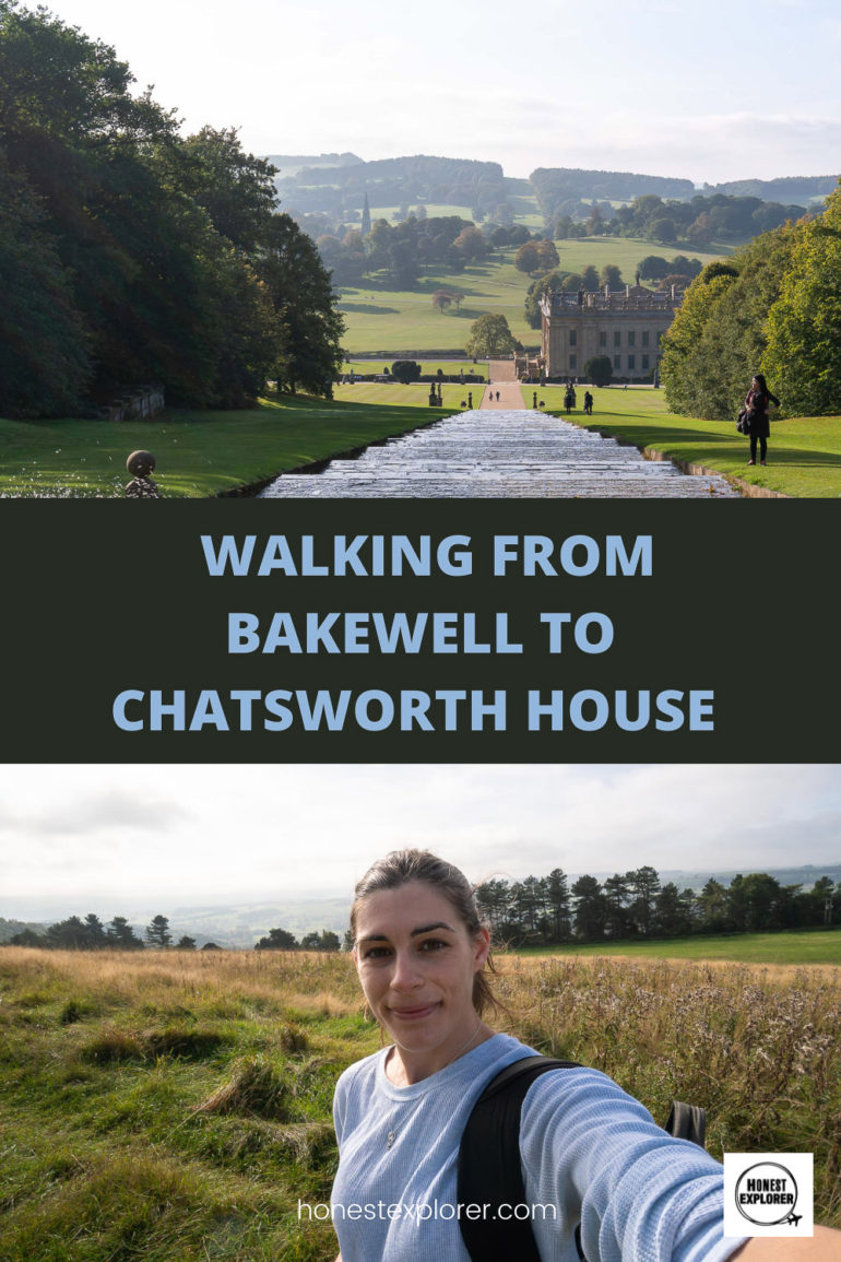
Once over the road, you will see a sign for Chatsworth House, just continue along the path straight on and the house will come into view. And you have made it!
After crossing from Edensor village, walk staight over to Chatsworth park.Chatsworth House in all its glory.
Take a well-earned coffee break before heading to the house or gardens for more exploring! The house won’t take too long to walk around, depending on how long you spend in each room, I slowly walked through and was about half an hour, but didn’t really spend too long in each room.
The gardens you can spend several hours in, so allow at least 2-3 for this as you will want to wander around without rushing!
I took the bus back to Bakewell, the bus stop is right outside Chatsworth House and the last bus was at 5pm which was when the house closed, so worked out pretty well. Also, the bus ride was the most scenic bus I’ve taken in the UK!
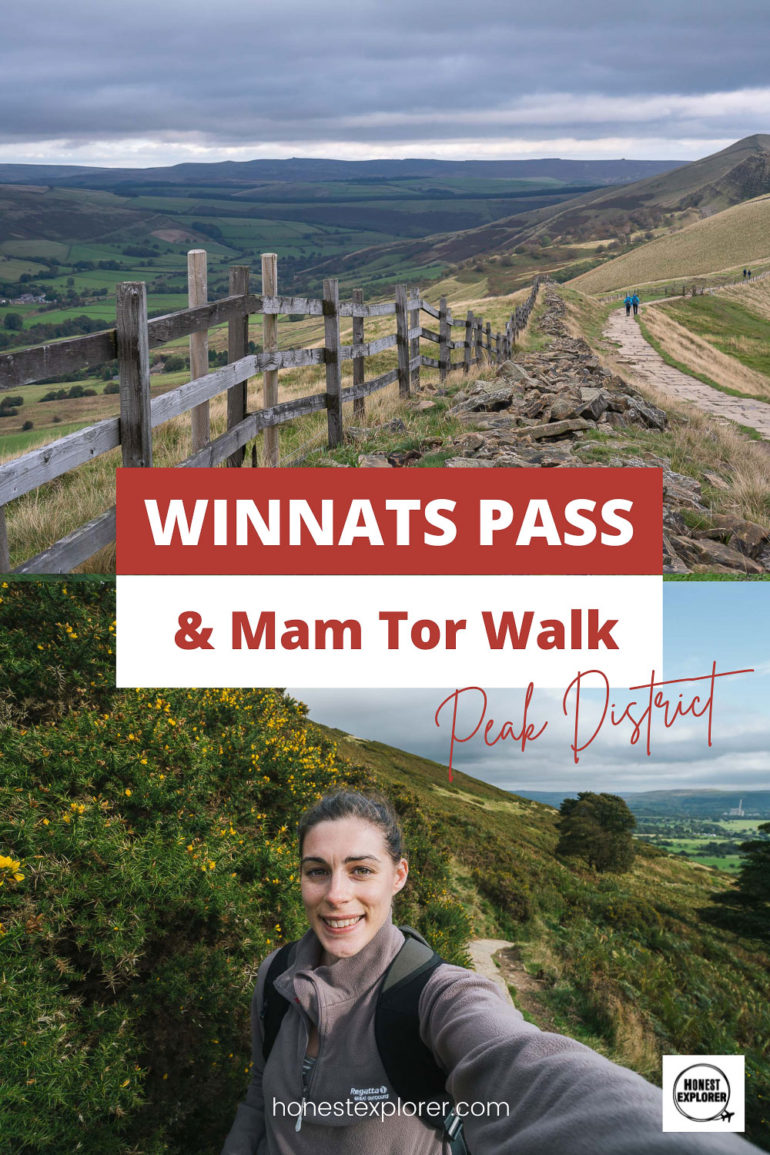
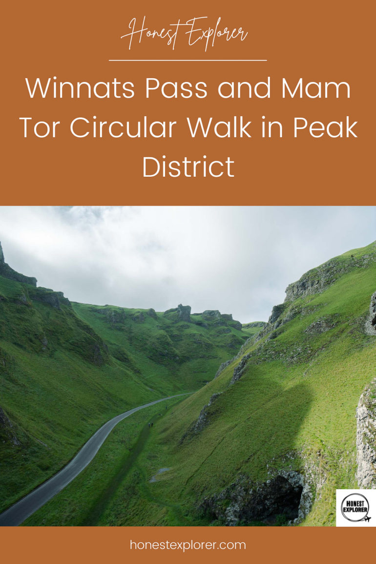
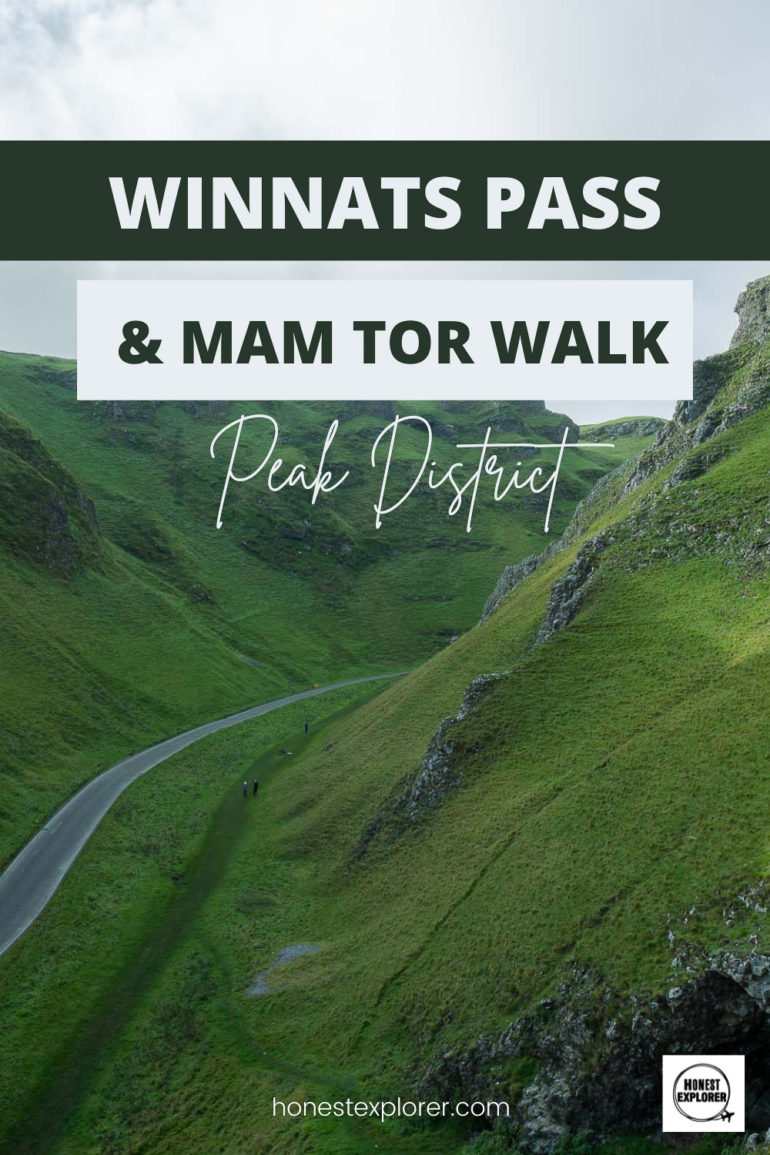
The Winnats Pass and Mam Tor walk is one of the most spectacular in the Peak District and a favourite of many hikers.
The walk starts from the Castleton visitor centre, will go up Winnats Pass and down, and then up to Mam Tor and along the ridge, before descending back to Castleton village. You can expect beautiful views over Winnats pass and Hope Valley from the Great Ridge.
I have provided photos to help guide you along the same route that I took.
Walk Type: Circular Walk Difficulty: Moderate Distance: 5 miles (8km) Hiking Length: 2.5 to 3 hours
Getting to Castleton
Castleton is one of the most popular villages in the Peak District and is very accessible by public transport. The small village is very picturesque with several pubs, cafes, and restaurants, and lots of cute shops selling all kinds of handmade goodies.
Getting to Castleton by:
Car: If driving to the Winnats Pass and Mam Tor walk, then the most convenient place to park is the visitor centre car park, which is where this walk starts and ends. This can obviously fill up quickly, so if there are no spaces, you can try the Mam Tor car park, or along the road from Castleton to the start of Winnats Pass (these spaces are free so get there very early to avoid dissapointment!!).
Train: The closest train station to Castleton is Hope (Derbyshire). Most trains will come from Manchester or Sheffield. It will take around 45 mins to walk to Castleton, or you can get the 272 Sheffield’s Peak link bus from the end of station road, into Castleton village which takes around 5 minutes.
Bus: The 173, 271 or 272 buses all stop in Castleton, running from/ between Bakewell or Sheffield.
Castleton village.
About Winnats Pass and Mam Tor
Winnats Pass is situated in the White Peak area of the Peak District (Mam Tor is the Dark Peak area). The huge limestone cliffs tower high over the winding road, which believe it or not used to be underwater. The whole area used to be under the ocean, with evidence of this in the rocks of the cliff face, where you can see fossilised sea creature remains.
There is also a spooky legend about the pass, which is that it is haunted by a couple who got murdered there back in 1758 by miners. Their bodies were found years after the event, but stories say some can still hear the howl of their screams at night…creepy!
Mam Tor is 517m high and overlooks Winnats Pass, Hope Valley and Edale. Mam Tor means ‘mother hill’ as it is the largest of several hills below it, which have appeared from the various landslides over the years. The hill is a little steep but it is not for long and anyone with a reasonable level of fitness will be able to do it.
Castleton to Winnats Pass and Mam Tor walk
The start point for the Winnats Pass and Mam Tor walk is the Castleton visitor centre. There are public toilets at the centre so make sure to use these as there are none on the rest of the walk. Also make sure you have snacks and water with you. There are plenty of places to eat in Castleton after your walk too!
Make your way along the road out of the village, past the Three Ducks Café and towards Winnats Pass. After around 10-15 minutes you will veer left off the main road to a small car park at the bottom of Winnats Pass. Here you have an option to walk through the pass (although there is a steady incline) and take in the awe-inspiring landscape from below, or you can choose to climb up the steep path directly.
I tried to follow directions I saw online but feel I may have taken the wrong path, but I did see someone else walking the same route, so I guess it’s fine! I will explain the way I walked, providing images along the way, which will hopefully be helpful to you.
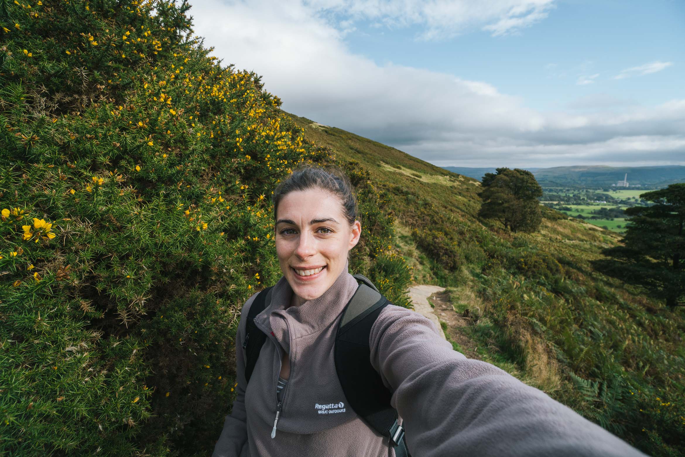
Starting from the bottom of the car park I started walking up the steep hill and to the left of a fence going up. This part was extremely steep, and I had to get on my hands and knees in parts. If it is wet be careful here and stay away from the edge (obviously, but it is super windy up there!).
I walked up on the right side of the tree (this is just above the small car park).Follow this fence up along the steep hill.
Carry on walking up this steep bit until it evens out. Turn back around and take in the views from here as they are pretty spectacular!
You will also be walking right next to the sheep, but they won’t cause you any harm! You will then come across a small gate, which you turn right into, and then straight through another gate on the left. After this, it is pretty flat, across a grassy patch.
When the hill evens out go through the gate behind me (which will be on your right), an dthen immediately through another gate on the left.
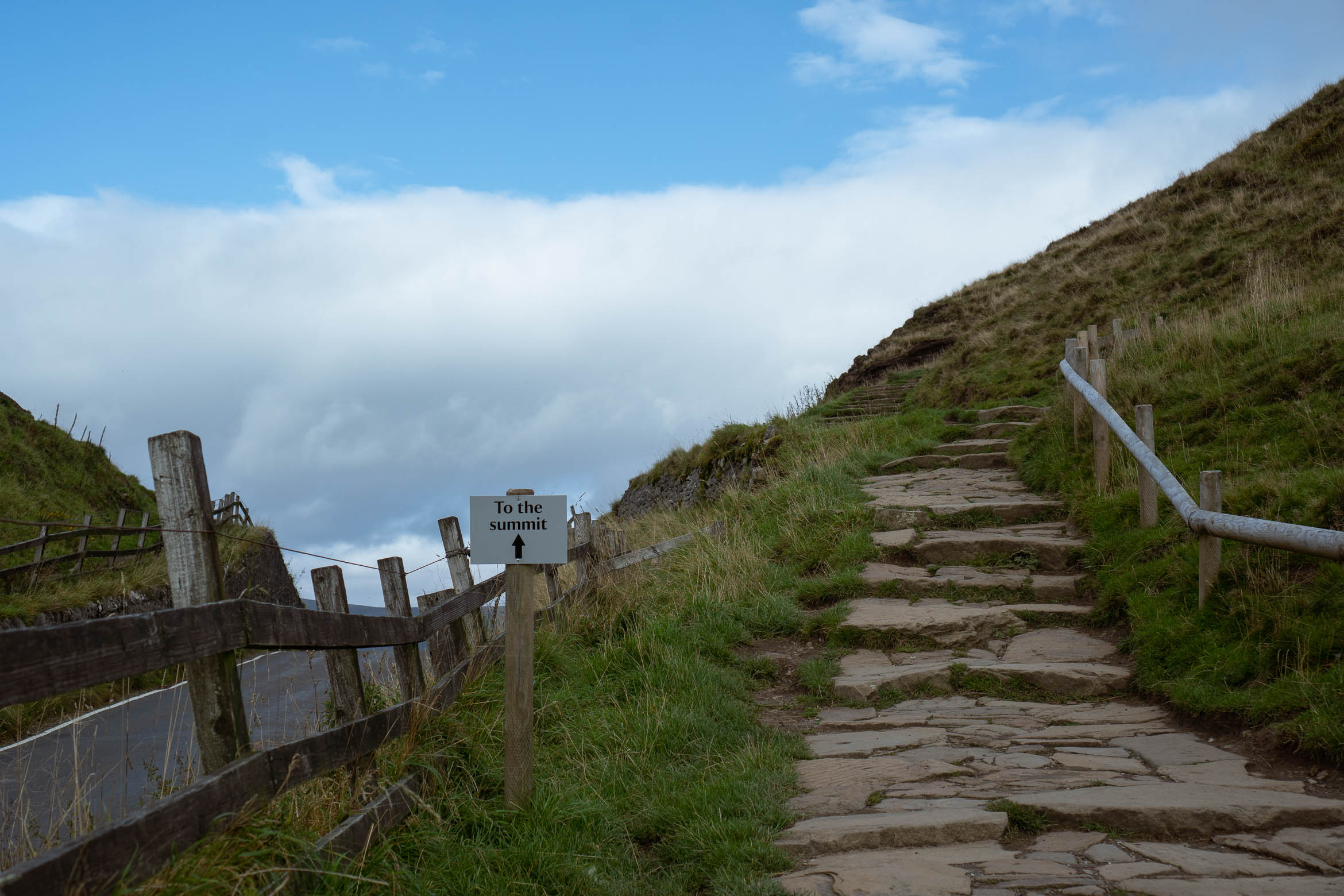
You will see Mam Tor in the distance and people walking up the trail. You will come to a gate crossing a small road, go straight across and follow the grassy path round to the right, crossing over another road. This will take you to the start of the Mam Tor track.
Walk across the road and straight on.The start of the Mam Tor walk… just follow up!
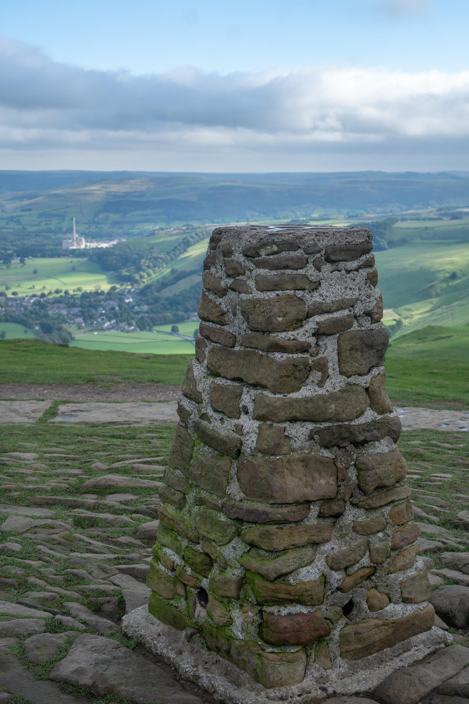
From here, it is pretty straightforward, just follow the path up to the summit, stopping to take in the views of Edale road to the left. The summit is a great place to stop for some snacks and take in the wonderful scenery. Then continue along the ridge, not forgetting to take some pictures, it is a stunning path!
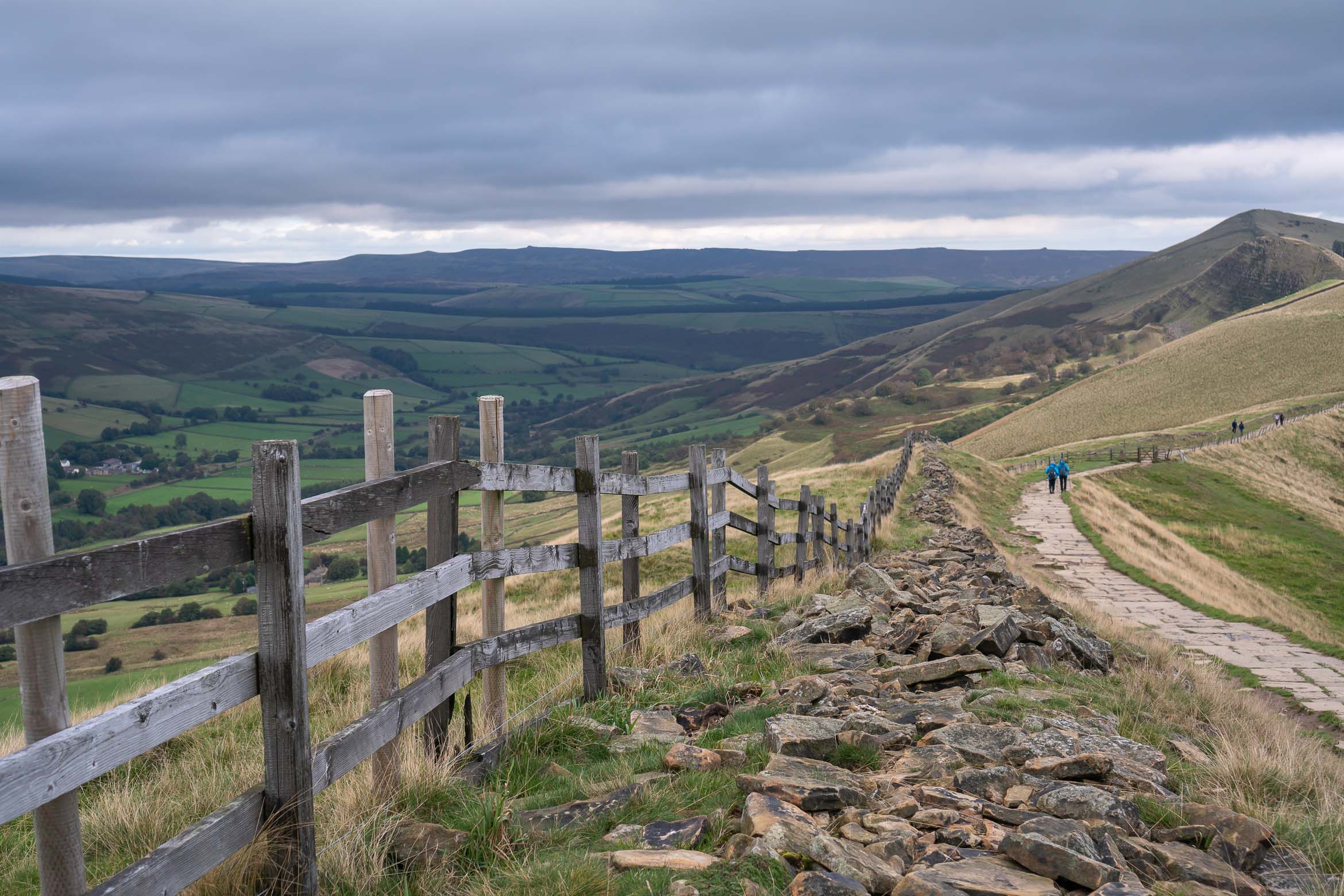
Mam Tor summitCarry on down along the ridge path.
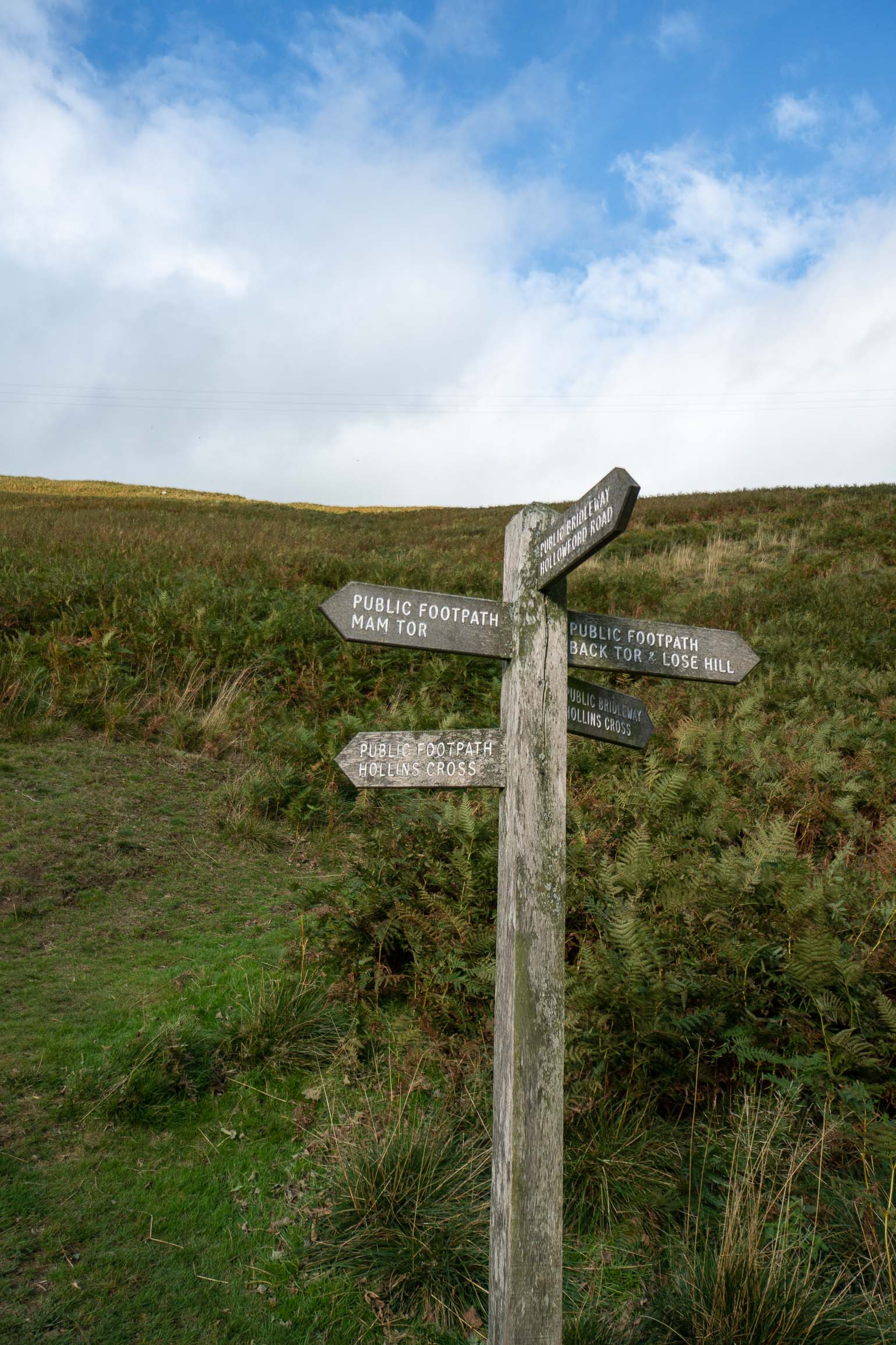
After some time, you will come to three stone pillars and a gate to the right. I took this path back down, but you can continue on to Hollins Cross if you like. The path back down was really pretty, and the scenery changed a bit, with some wildflowers and ferns growing along the side of the hill.
Path back down towards Castleton
Eventually you will reach a gate by a tree, which leads down a small rocky path (the signpost to Hollowford road). This path had turned into a little bit of a stream when I was there but not too bad! Take this path and follow the road round to the right (it will lead onto a tarmac road). This road will take you back into Castleton village.
And you have made it! Now take a well-earned rest with a beer or slice of cake (or both!).
The path from the ridge should lead to this signpost. Take the Hollowford Rd sign.Take the path through the gate. Its a narrow path that may have a trinkle of water running down it!Road leading back to Castleton village
Where to stay in Castleton
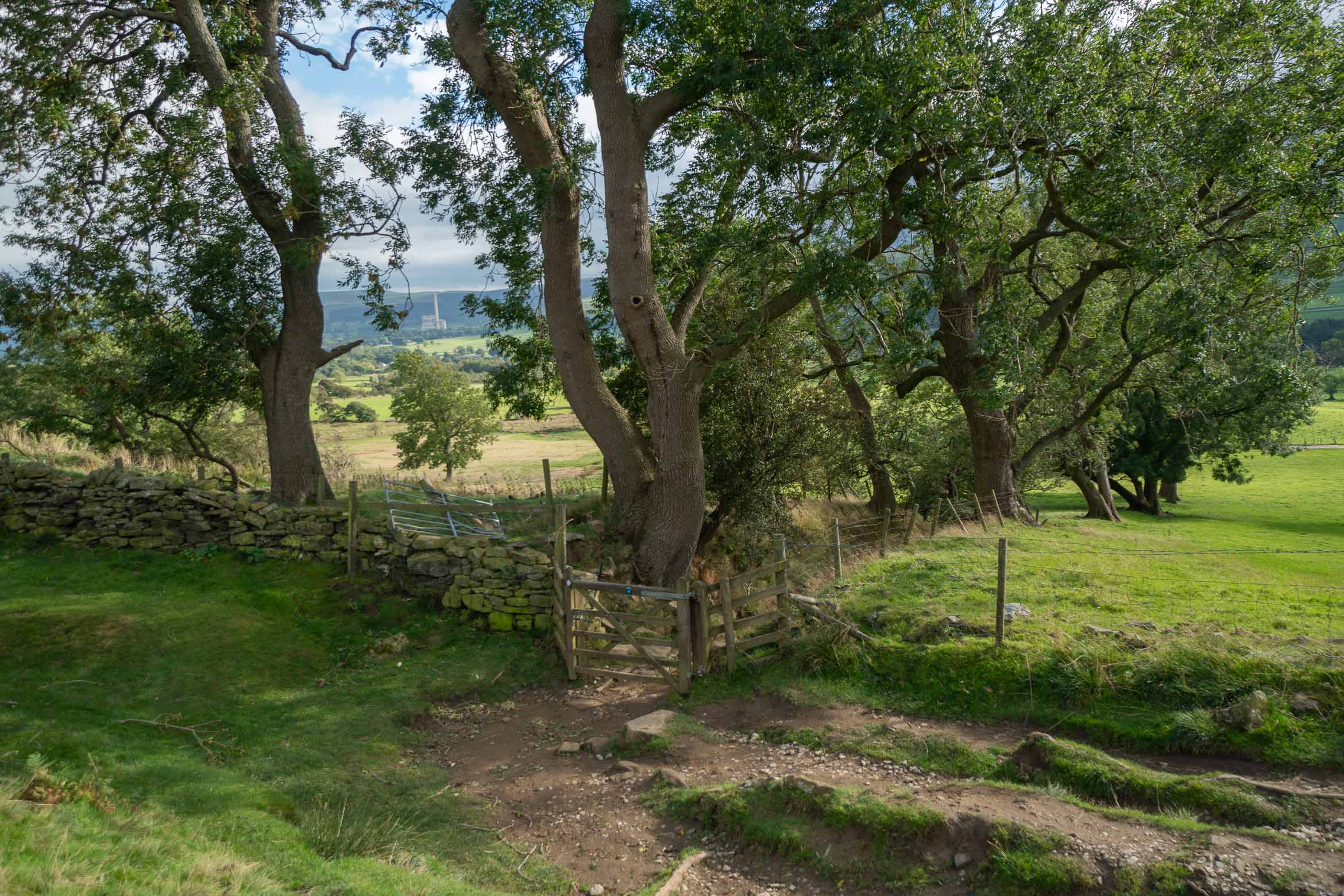
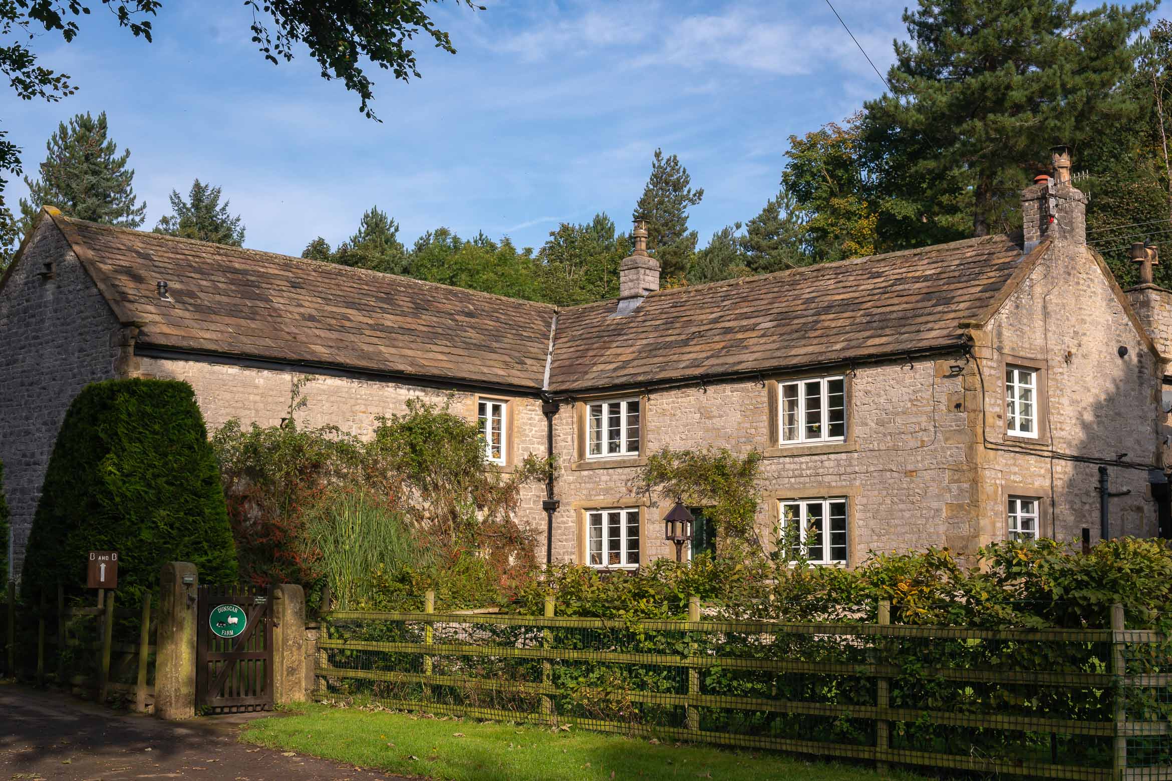
There are plenty of spaces to stay in this popular village but if travelling in peak season I would say to book as early as you can as the best places will fill up quick. I stayed at Dunscar Farm, which is a 10-15 min walk from the village.
I would definitely recommend this place, the owners are so friendly, and the views of Winnats Pass are amazing from the farm. It is close to the start of Winnats Pass, you just walk to the end of the drive and then cross over a field. It is also lovely and quiet with stunning views all around.
Hiking in Peru is pretty specialPeru has got to be one of the most scenic countries I’ve visited, with pretty much every terrain possible. The landscapes will vary from jungle to beach, to desert and mountains. The small trekking town of Huaraz, sitting at just over 3000 metres is surrounded by the Cordillera Mountain range making it an excellent place for trekking.
There are many treks you can do here, from day hikes to full on mountaineering. I have bad knees so opted to do 3 easy-ish day hikes.
Acclimatisation Hike, Huaraz
This was supposed to be an easy hike to get me used to trekking at altitude but I found it utterly exhausting! Still without practising who knows how I would have fared on the harder treks! I hired a guide just for myself and we hiked up to Laguna Wilcacocha.
Needing to stop after about 15 mins!
It’s around 15 minutes out from Huaraz and easily reachable by public transport. You will start at just over 3000 metres and walk up to the lake at 3720 metres. The path is not too clear at times but it’s pretty much straight up. It will take around 2 hours on the way up and about half that going back down.
Steep!
On the way to Laguna Wilcacocha you will pass through local houses and farms– just try to resist taking a picture of their sheep! They believe it will bring bad luck. A farmer shouted at me for trying to take a picture of the animals and my guide explained they still believe that it will take a piece of their soul.
Closer to the top you will see snow capped peaks in the background. The lake itself is a little underwhelming but to make up for it you do get pretty stunning views over the valley with the mountains in the background.
Laguna Wilcacocha.
I did find this walk a bit of a challenge but then I do have weak knees. For most reasonably fit people I think it’s a fairly easy and cheap way to acclimatise and to see how your body copes walking at altitude.
Laguna 69 Trek
Just look at that colour!
This is a popular day hike in Peru, all you need to do is see a picture of the lake to decide it’s worth it. This is a challenging hike so to have that mental image of the end goal is motivating. It was one of my favourite treks in terms of scenery but also one of the hardest.
Laguna 69 is beautiful icy blue/green lake sits at 4600 metres above sea level. This is pretty high as people start to feel the effects of altitude sickness at 4000 metres. Bring lots of water and snacks and take it slow.
Hiking through grassland lower down
Walking up will take around 3 and a half hours and 2 hours on the way back. The first part of the trek is pretty steady and you will walk through grassland, past grazing cows, over streams and denser green vegetation.
About half way it starts to get harder, the path gets steeper and the air gets thinner. You may only walk a few yards and be out of breath. But just as you feel like giving up you will see a tiny glimpse of that blue lake.
Can just about see Laguna 69
The final 15 minutes are surprisingly flat and seeing the lake in full view is breathtaking. Some crazy people went for a swim in the icy blue water, I was so tired I slept for almost an hour! (managed to take in the scenery, eat my egg sandwich and take pictures but then I was out for the count).
Coming back down was a lot easier, the more you come back down, the more energy you feel! Returning the same way you see things from a different perspective and anything you may have missed trekking up.
The Laguna 69 trek is extremely difficult at times but it’s definitely do-able and totally worth the effort. I have bad knees and still managed it even though in some pain, so for any reasonably fit person I’d say its manageable but will be challenging. There are some amazing photo opportunities and scenery to keep you going on this trek and that end result is most certainly worth the hard climb.
Taking a break from trekking
Pastoruri Glacier Hike
This is the highest of all the hikes at around 5000mt but the one I found most easy, although I was well acclimatised by this point. Acclimatisation is KEY, I would not have been able to do this at the start of my trip and probably would have felt very ill with the altitude.
I was booked on a massive coach with around 50 or so people from the town of Huaraz and they take you pretty high up before you start hiking. The trek is only 1 hour but pretty steep. You could also hire a mule to take you up halfway but most people walk it.
Hiking up to Pastoruri glacier
The half way point is pretty scenic with the horses and mules standing in front of a snowy mountainous background and the path is well paved. The last part towards the glacier is over rocky terrain but I would say running shoes are still ok to wear.
Peru does have a wonderful backdrop 🙂
Once at the glacier you can pose for photos and are able to touch the ice. Pastoruri Glacier is slowly melting so it’s smaller then it once was but still an impressive sight, especially with the backdrop of the blue water and towering mountains.
The melting glacier
This is only an hour hike BUT be sure to be well acclimatised before as altitude sickness is common. The tour will also take you into a valley where the Puya de Raimondi plant grows. It looks like a giant cacti but (fun fact) it’s actually relative of the pineapple family.
An impressive day tour to round off a weeks trekking in Huaraz. If you know someone who loves hiking then share this post 🙂
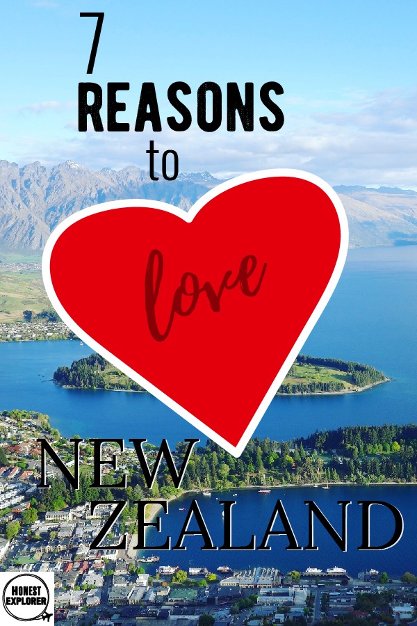
New Zealand is one of those countries that holds something for everyone. With spectacular scenery and heaps to do, a trip here will no doubt leaving you wanting more. Here are my top 7 reasons why you should visit NZ now!
Spectacular Scenery
One of the best things New Zealand is known for is the incredible landscapes it has to offer. From snow-capped mountains to lush green farms, gorgeous beaches, jungles and cosmopolitan cities. It’s one of the most scenic countries I’ve been to with ‘wow’ moments around every corner.
Visit New Zealand All Year Round
The great thing about NZ is that every season has something to offer. In winter the mountains are covered with snow and the ski parks open up. In spring the flowers start to bloom and there are cute baby animals everywhere. Summer has great weather for walking and outdoor activities and the trees glow golden orange in the Autumn.
Friendly Locals
The local New Zealanders are some of the friendliest people around and always happy to help if you find yourself lost. It’s also great to get talking to locals as they know the best places to go, so a great way to get insider knowledge.
The Adventure Capital
Your budget could disappear pretty quickly with so many adrenaline activities to do! There are so many fun things to do here from jet boats, bungy jumping, zip lining and white water rafting. You wont get bored quickly here.
Hiking is Free
New Zealand can be an expensive place with all the activities on offer but luckily pretty much wherever you go there is some kind of hiking trail. They range from easy day walks to longer trails taking a few days. Hiking in NZ is not only free but totally incredible with it’s stunning scenery.
It’s Easy to Get Around
With bus companies like intercity or naked bus, travelling around the country has never been easier. Buy a bus pass for however many hours you need and book online as you go. Self driving may work out a bit more but it’s also a great way to travel around the country.
Good Coffee
New Zealand along with Australia is known for great coffee and I can totally agree with that, as I spent most of my time on the hunt for delicious coffee! If in Queenstown, check out a great place called ‘Joe’s Garage’, this was my best coffee in NZ!
Is New Zealand somewhere you’d want to visit?! Or maybe you’ve already been…fav places? Would love to hear your thoughts below.
Four amazing days, tired feet, injured knees, ups, downs, gringo killers, great food, funny guides, watching stars by night, early mornings, late night rum, all came down to this.
Not bad…
Standing above the grey clouds, cold and wet and wearing a brightly coloured yellow poncho bought from a cheap Cusco market, I look around at this magical and mysterious place, wondering how I ever made it here. This remarkable place could almost seem entirely secret, if it wasn’t for the daily herds of never-ending tourists of course. Trying to suppress my minor disappointment at the weather I look around at this wonderful place named Machu Picchu. I’ve actually made it.
Cusco, the starting base.
Lets journey back a few days…
Arriving at Cusco, which sits at 3400m, I feel an altitude headache arise. A handful of loose coaca leaves in hot water prove to be a great cure and my headache soon vanishes. Must remember to leave the coaca leaves behind before flying home though! The cobbled streets of Cusco pack a big punch with quirky local markets and many adventure activities like rafting, mountain biking and horseback riding, all within easy reach. It’s easy to spend several days here. Inca ruins are found in the surrounding hills, with the Sacred Valley being nearby. Luckily, the town is the starting point for the majority of tourists headed on the Inca trail, so there are many hiking shops around.
Walking poles are a must as frustratingly I have patellar tendonitis on both knees. Determined not to let it stop me. I’m also buying a lot (and I mean a lot) of snacks. More is more in this case! I would hate to run out of my snickers and cereal bars half way up the mountain. Machu Picchu is set amongst the Andes mountain ranges and sits at 2430m. That’s a fair amount of fuel needed, so I pack my bag with the essentials to make sure it fits to the required weight limit. I try to pack light and for changeable weather. Just about manage it, feeling ready and eager to take on this challenge.
Views from day 1
So the first day of the trail begins and I’m picked up at the ungodly hour of 4:30am and driven to Ollantaytambo, a local village. Surrounded by green rolling hills, I sit in a small hut with chickens, children and guinea pigs running around my feet whilst having a simple breakfast, prepared by a local Inca family. This is my first chance to meet the other trekkers I will be with for the next four days. I was pleased with my group of mid to late twenty something’s, as well as two guys from another group in their late fifties and much fitter than the rest. They would soon be ahead of us for the whole trek.
And…back up again
We are driven in a minivan to the start of the Inca Trail, nerves and excitement at the forefront, walking poles and knee bandages prepared. Once through there’s a tad sense of false security as a gentle path gradually leads us up. I’m sure it will get harder! The rain starts almost immediately and the colourful ponchos are straight on, rain not beating us just yet. I can’t believe how great the scenery is, stopping what seems like every five minutes to take a photo.
steep steps
We walk past small Inca sites, endless green hills and mountains hiding behind one another, only giving us a glimpse of the challenge ahead. Day two, I know is the hardest and on everyone’s minds as we plough along, wondering what we’ve got ourselves in for. We arrive at camp to find it’s already set up by the porters.
These admirable men, some the age of most grandparents, carry 20kg whizzing past everyone to have camp set up and food cooked before we arrive. In the past they would carry up to 60kg until it was legally put a stop to. With little pay and no complaints I am in awe of these men. The food is delicious, with a combination of soup, meat, rice, pasta and a sweet pancake for dessert. After dinner everyone goes to bed but I stay up to watch the stars, so bright and so many.
I wrap up warm and sit in amazement at the dancing stars, hoping this peaceful and magical moment is one I won’t forget.
The portersAt camp
The Second Day…
Day two, wake at 6:30am smelling fresh mountain air, for a breakfast omelette to fuel the toughest day of the trek. This is the day considered most challenging and climbing a 1000ft in a day, I can see why. It’s pretty much uphill for 8 hours to reach Dead Woman’s Pass at 13,828ft (the highest point of the trek). Supposedly the rocks from below look like a woman lying on her back, the name doesn’t mean that you will be dead once at the top! (or at least I hope not).
Dead Womans PassTrail down from Dead womans pass
At altitude everyday things such as breathing suddenly become increasingly difficult but I push on to be near the front, as mentally cannot be at the back. The air gets thinner. I’m frustrated as my mind and body want to push on but my knees hold me back. I power through this mental mind game and arrive as one of the first to Dead Woman’s Pass, much to my surprise.
Walking down from Dead Womans Pass
Soaking in the views and accomplishment just achieved, we wait for the others, cheering them on as they reach the top. Through laughter and tears we have made it, now just need to head back down the other side. So yes I was at the back from this point onwards, as apparently knee injuries and steep down-hills do not mix. The views keep me going. The thought of food also keep me going. Finally I make it in time for dinner and relax with the group, playing card games and chatting about the day.
That night the porters give me a little warm rum before bed and I sleep like a baby.
Mountain scenery
I had a tent to myself! 😀
Day 3 on the Inca Trail
So after covering my ever-increasingly greasy hair with a hat, I’m ready for one of the most scenic days. I certainly see why Machu Picchu is one of the ‘new’ seventh wonders of the world. Day three takes you through jungle and mountainous backdrops, the sun streaming through the trees and birds flying overhead.
Feeling tired on day 3Rainforest section on day 3
We stop for lunch opposite a group of Inca ruins. The Americans have already eaten and are now off to face the gringo killers. That would be downhill steep steps for forty five minutes and which go on far too long for my comfort. I shuffle down them using my hands, like a baby learning to walk down the stairs. After surviving this, I find a birthday treat for me at camp. The porters have baked an entire cake half way up the mountain, making me feel extra special indeed.
Inca ruins along the wayThe dreaded gringo killers
Ok so the final day has arrived and after heavy rain throughout the night, it’s still ongoing and everyone is miserable. I try to be positive hoping the rain makes way to pretty sunshine. After two hours of walking, mostly under the trees and then passing through the compulsory checkpoint, a member of the group shouts “Look!”.
I raise my eyes through the slowly drifting clouds to see the extraordinary Inca ruins that make up this ancient city. There, in front of me, is the image that has been driving me since day one. The one thing I have kept in my head, willing me to continue through tired legs and hurried breaths. I am finally looking down at Machu Picchu.
I made it!
The rain in no way hides the beauty of this place. These ruins are believed to have been built at the height of the Inca empire during the fifteenth century and were built entirely without mortar. They were later abandoned and I can only imagine how thriving this place once was. I’m particularly impressed with the intelligent system leading water from a spring and using gravity to feed it through to various parts of the city.
Hoards of day tourists
There are a lot of tourists here and I wish I were alone to take the setting in with all its wonderment. Clouds drift slowly through the mountains and surrounding the ruins, adding a prehistoric feel to this already mysterious place.
Machu Picchu in the rain
After a quick tour, exploring and taking photos we head through the huge number of day tourists, all smelling great as opposed to us and take a bus down to Aguas Calientes. This small town is busy with tourists strolling around, looking at gift shops and dining for lunch after their trip. Like most, I take this opportunity to visit the hot springs, a life saver after four days of walking and I feel the pain slowly fade away. Feeling much more relaxed we all fall asleep on the train back to Cusco.
Aguas Calientes
A bath has never felt so good and I feel like a new woman. This journey has been tough, exhilarating and exhausting but one I will never forget. I’m glad I chose the classic trail, with it being great for diverse scenery yet still a nice four days, as opposed to some of the longer treks. Back at the hotel a surprising amount of energy has taken over my body and I decide to join the rest of the group at a small bar in the town square. The hours and hours of walking have apparently not quite defeated me just yet and I dance the night away, celebrating my small little victory.
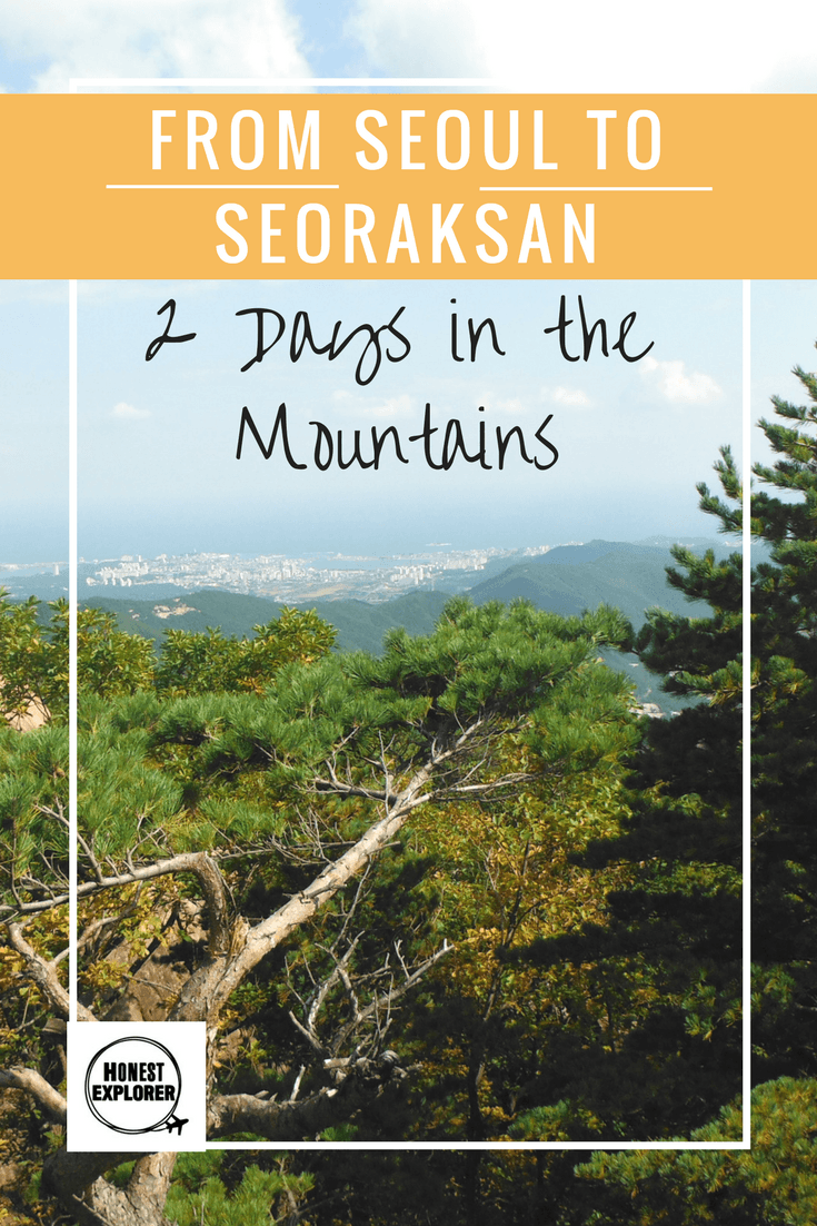
So after exploring the city of Seoul, I wanted to check out the mountains of Seoraksan, especially being October as the leaves dramatically change colour from green to vivid oranges and reds. Although, any month of the year is a great visit, with snow covered mountains in winter and flowers budding in Spring. There are also several temples in the park, and many levels of hikes through the trees or via the clear mountain streams. It’s a bit of a task coming from Seoul but totally achievable and well worth it (directions at the bottom).
View from top of gondola
Day 1 in Seoul
I wake at 6am in Seoul and get the subway to the Express Bus Terminal, buying a ticket for Sokcho. Traffic is good so the bus only takes 2 and a half hours to reach Sokcho. As I’m trying to find my way to the local bus stop, I get talking to some other girls and we find the bus together. This bus will take us to the village closest to the mountains. One of the girls is Korean, very hyper and funny, asking everyone on the bus if they know where my stop is and even phoning the hostel to ask them. The kindest of strangers never ceases to surprise me. I get off at the small and quiet village near to the National Park and at Goodstay Smile Resort I’m greeted by a really friendly women but who speaks no English!
Goodstay Smile Resort
View from guesthouse
Not wanting to waste time, I drop my bags down and head out for the mountains to make the most of the day. I take the cable car up the mountains, overlooking beautiful views. There is a massive rock many people are climbing so I clamber up to the top like everyone else. The views from the top are fantastic.
On top of a big rock 🙂
I bump into the girls from earlier and we walk together to the big Buddha and temple. We take an easy-ish walk to a rock that’s tilted on its edge and has been named ‘the pushing rock’ as everyone tries to push it over, not succeeding of course. We take pictures at another group of picturesque temples, the sun shining and leaves starting to change their colour all around us. The park is beautiful with the sun streaming down and clear streams meandering through the forest.
New friends
Big Buddha
Pretty hiking trails
After a lovely day in the park I decide to walk back to the hostel which takes 40 minutes down a never ending road but I make it to town and order a dinner of a big pot of rice, including many side dishes, as is custom in Korea. The funny lady in the cafe starts mixing my food for me and showing me how to eat! Back at the hostel I find I have the whole dorm to myself and chill out on the floor, enjoying the under floor heating!
Koreans love their side dishes
Day 2 in Seoraksan
Perfect hiking weather
The sun is shining once again as I take the 5 minute bus to the entrance, stopping briefly as a big group of Korean men ask to have a picture with me (bit weird). I walk through the trees and glistening streams, clambering up rocks to finally reach a waterfall, which turns out to be quite small but nevertheless a nice spot for a quick sunbathe. I rest for a while as the walk was quite steep for me. The waterfall is pretty and most people are also sunbathing and enjoying the tranquil setting.
Waterfall rest stop
Gorgeous views
As hunger strikes I head down to the mountain cafe for ‘hot noodle’ (delicious!). After my stomach is satisfied I head off again on a much easier walk this time. It’s really pretty with the leaves changing colours, although I’m a little early for the full effect of Autumn. I walk by a bright blue stream with crystal clear water, taking a small rest and just listening to the sounds of nature. I feel so calm in this moment.
Clear waters
As I’m leaving, an older Korean man starts talking with me and wants me to eat with him. It’s a bit wired so I explain that I’m just leaving so don’t really have the time. He continues walking with me to the exit, offering me bread which I kindly refuse. He says “ok nice to meet you” and walks out of the exit. I wait a few minutes and then walk out briskly trying not look around (really don’t want to bump into him again). Then when I’m clear of the park I here “Hello!” (ahh damm), I knew he would wait! He offers me a lift but I insist on walking and after a while of walking along with me he eventually heads off. Well that was annoying but at least I got rid of him!
Park Entrance
Back at the hostel I sit and eat with the owners son Tey, whilst waiting for my night bus to Busan. He is very welcoming and has great English. There is also a primary school group staying there and the 2 young teachers come over and buy me some blueberry milk (people are so nice here). The school kids are headed into town the same time I need to get my bus, so the teacher waits at the bus stop with me and lets the driver know where I’m going. I love how helpful the locals are. The group of kids smile and wave me off. Gonna miss this little town.
I really enjoyed my trip to the mountains, and whilst slightly challenging getting here, the mountains are a fantastic place to get away from the city. This was one of my favourite places in Korea and for nature loving hikers it’s a must do. Great any time of the year and a world away from Seoul, it’s a perfect weekend getaway from city life.
Getting to Seoraksan from Seoul
There are no planes or trains to the mountains so you need to get 2 buses. The first to Sokcho and then a local bus. I found the journey ok and people were very helpful. If you can find someone to write to name of your hostel down in Korean that would be a bonus. If not then show the driver a map of where you need to go.
Get subway or taxi to Seoul Express Terminal ( you can also get non-express buses from Dong Seoul Terminal)
Arrive early to buy a ticket at the counter or buy tickets at the counter a few days before to save time (you can buy some tickets online but sites are in Korean so can be difficult)
Buy a ticket to Sokcho (it will take 2-3 hours)
Get off at Sokcho Express Bus Terminal (should be the last stop)
Some hotels will be in Sokcho and some will be in the small town right by the National Park. Goodstay Smile Resort is right by the park. To get to the hotels close to the park you need to get on a local bus.
Get on the 7 or 7-1 bus towards Seoraksan National Park (the buses end at the National park, stopping off at the small town just before)
The local bus runs roughly every half an hour and will take around 40 minutes. You should have some small change to put in the box as you get on. Let the driver know where you need to get off, they are usually pretty helpful.
I would recommend leaving Seoul early to avoid delays and bad traffic, plus if you get the 6am bus then you can head to the mountains on the same day.
Have you been to Korea’s mountains? Which season sounds best?!
")
")


")
")


")