")
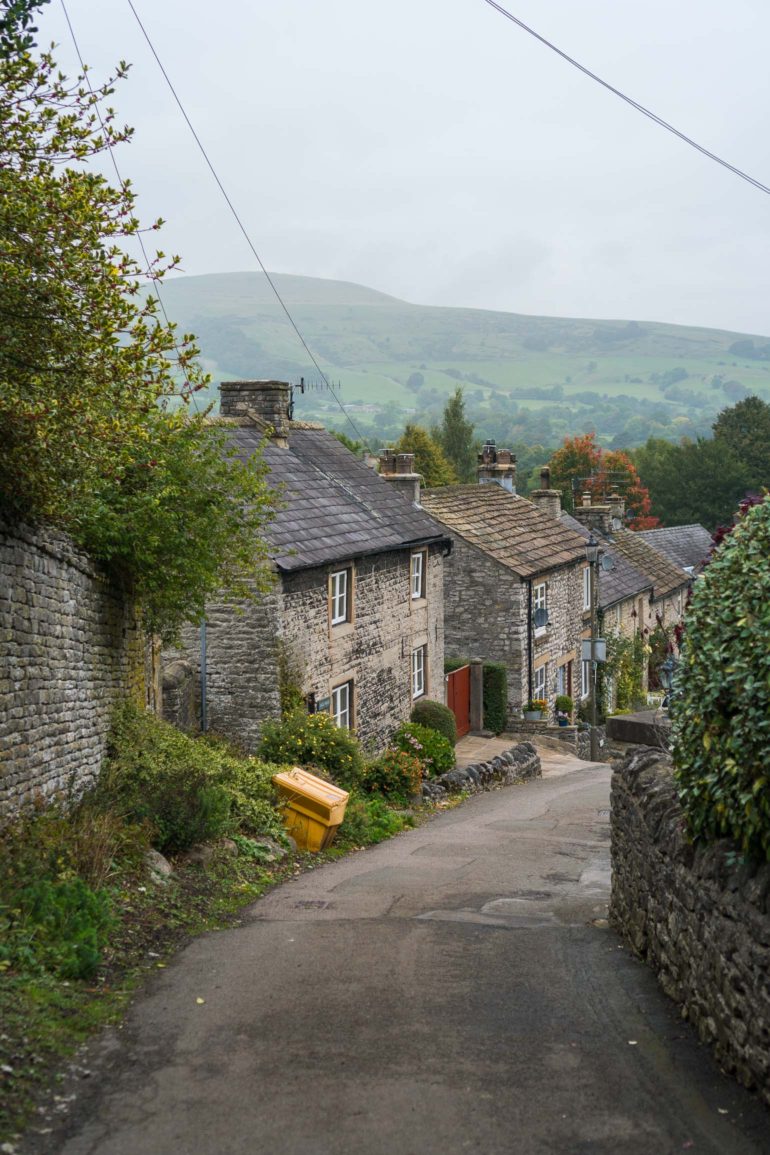
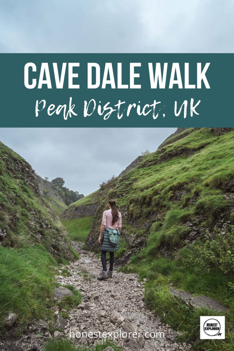
Cave Dale is a little hidden gem, situated in the popular village of Castleton in the Peak District. With several hikes and walks accessible from the village this is a wonderful place to stay for your Peak District adventure.
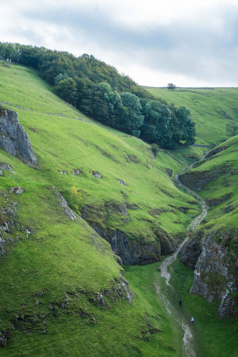
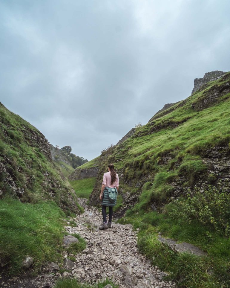
The Cave Dale walk is fairly easy, which gradually slopes uphill and then back down over some grassy fields. The first part however is very rocky, so do watch your step, as the stones can be slippery when wet.
Type of Walk: Circular
Distance: 2 miles (3.3 km)
Walking time: 1.5 to 2 hours
Where to start the Cave Dale Walk
You can start the walk from the pretty village of Castleton. The visitor centre has a café and public toilets, and the village also has many cafes and pubs to grab a bite either before or after your walk. Be sure to bring along some water and a snack too.
Getting to Castleton:
Car: There is a car park at the visitor centre and also at Peak Cavern car park. These can fill up quick so try and get there early. There is some free parking along the main road on weekdays, with paid parking on weekends.
Train: The closest train station to Castleton is Hope (Derbyshire). Most trains will start from Manchester or Sheffield. It will take you 45 minutes to walk from Hope station to Castleton, or you can get the 272 bus from the end of station road, into the village (journey time around 5 mins).
Bus: The 173, 271 or 272 buses all stop in Castleton, running to and from Bakewell or Sheffield.
Let’s Begin the Cave Dale Circular Walk
- Start at the Castleton visitor centre and turn left onto the main road through the village. Keep walking, past the Bulls Head pub (which will be on your left).
- Just as the main road starts to bend around to the left (by Ye Old Nags Head pub), turn right onto Back St (there signs for Cave Dale and Peveril Castle).
- Keep walking until you reach a small square with a war memorial in the middle. Keep left of the middle section and continue on Back St as it curves around to the left and turns into Bargate street.
- Just after the turn, you will see a brown sign on your left pointing towards the Cave Dale entrance. Turn right at the sign, it will take you through a small path between two sets of houses, so keep an eye out, as it is not immediately obvious.
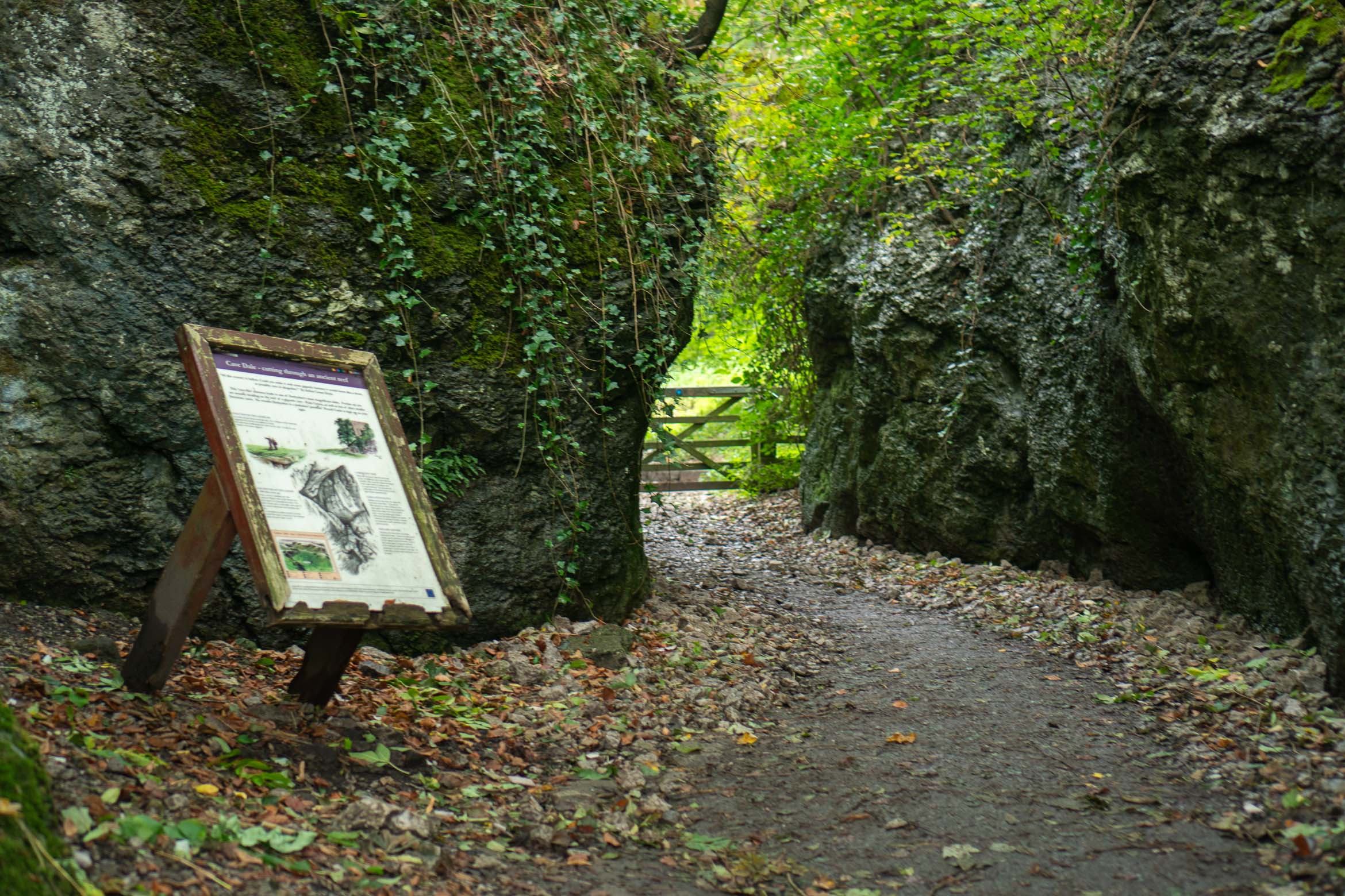
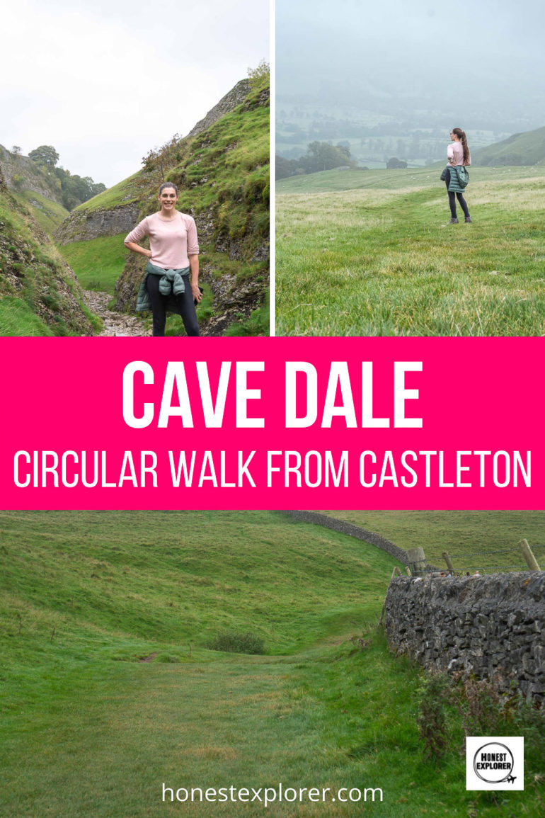
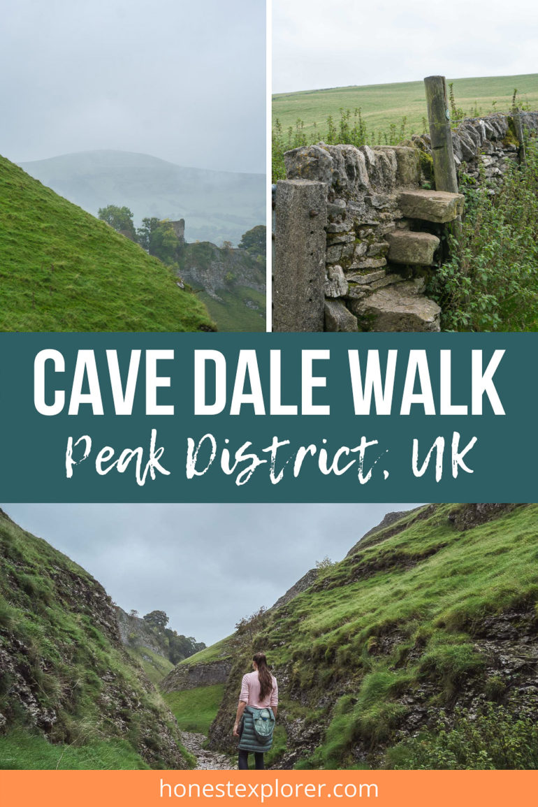
- This will lead to the entrance where there will be a sign and some interesting information about Cave Dale. Go through the gate and walk upwards on the rocky track. The scenery here is stunning, with giant rocks towering above you and green grassy hills on either side.


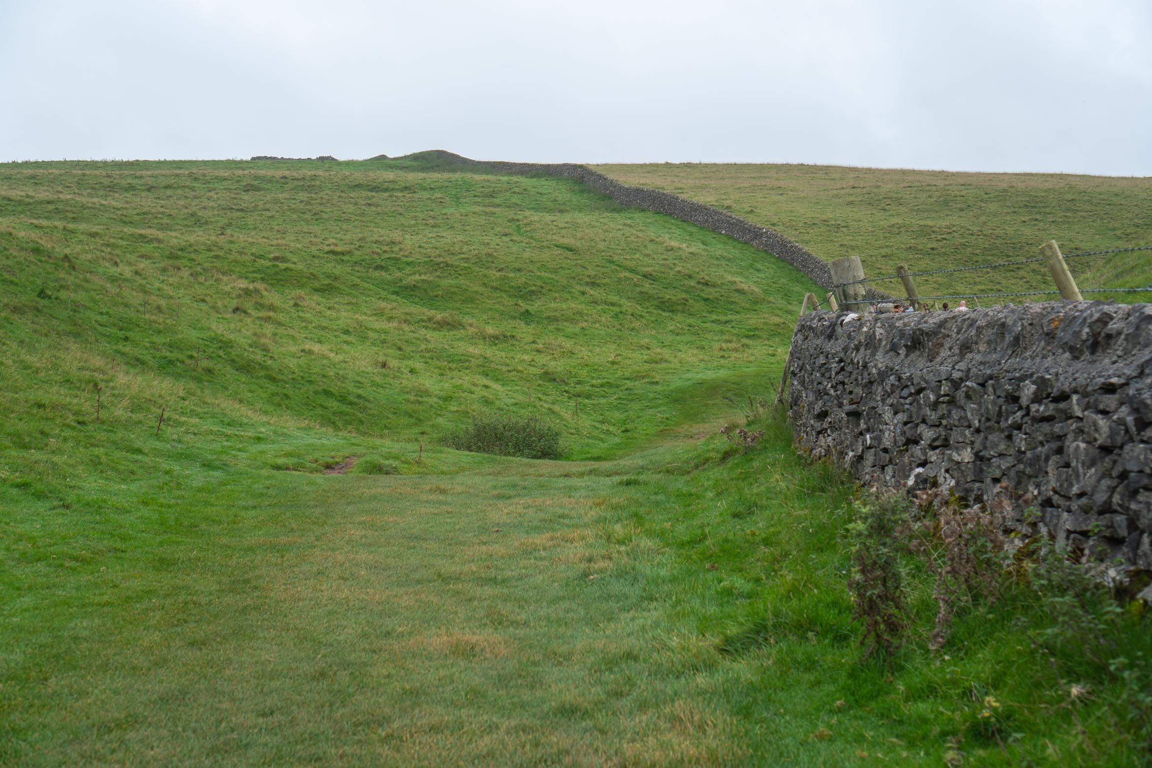
- Be careful with your step here as the rocks can be slippery when wet and the path uneven. Continue along, taking in views of Peveril Castle on your right. Soon there will be a boundary wall on your right side, keep walking alongside this until you see a gate in the wall. Turn right through this gate and continue through the fields for a short while.

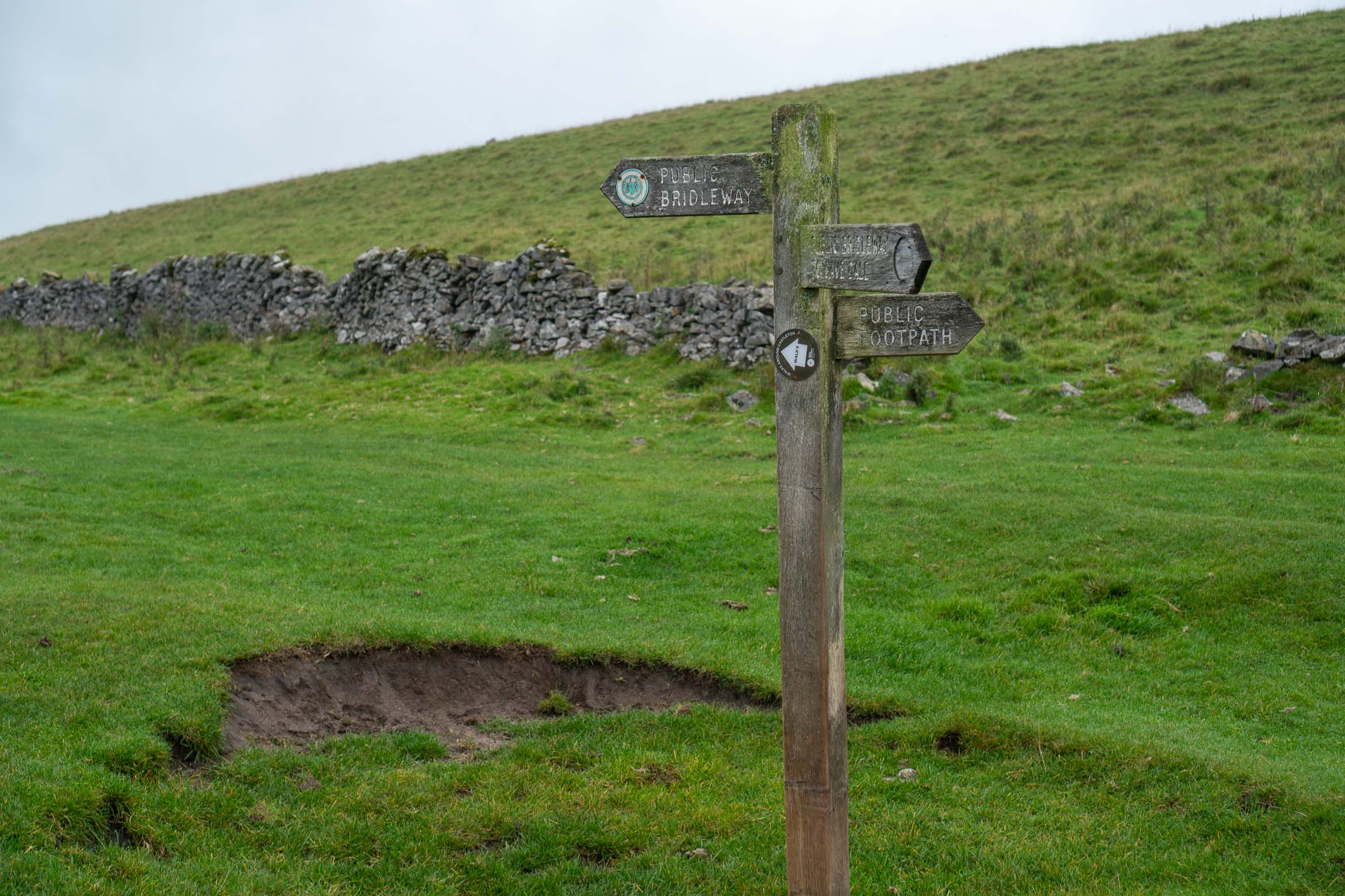
- You will eventually come to a signpost indicating the various footpaths. I took the one to the right, which almost goes back in the direction you have just come from. This will then bend around to the left and lead onto a grassy hill with a stoned boundary wall.
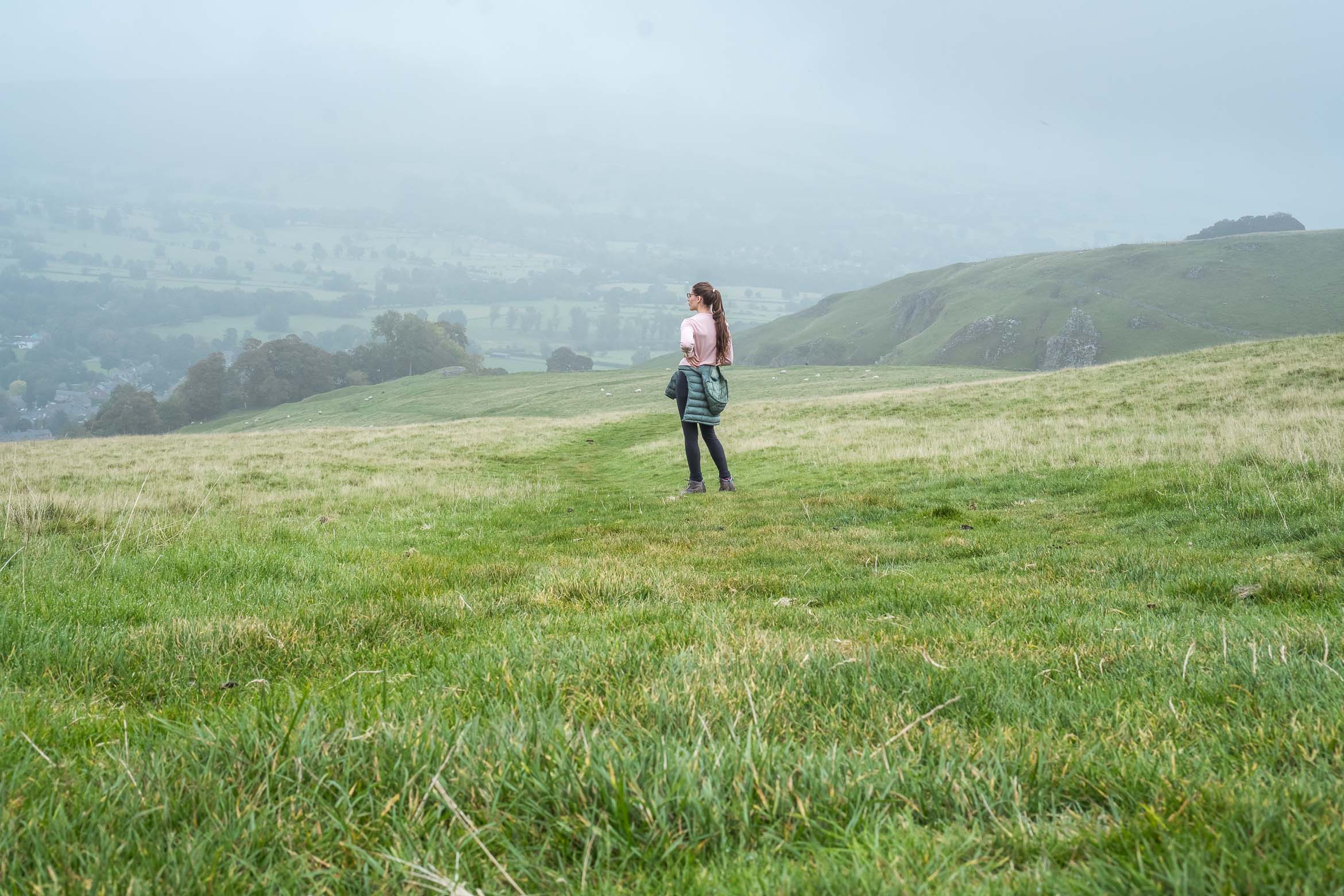
- Continue waking down this field until you reach a wall with some steps you will need to climb over. You will see the rolling hills in the background, with a view of Castleton village from above. Keep walking downhill to the tree line.
- I have a feeling I came out too far here as I walked right up to the tree line, before turning left down the side of the field. This was a quite steep path. I believe I should have turned left a little before the tree line, so the path is less steep, but either way it leads to the same place.
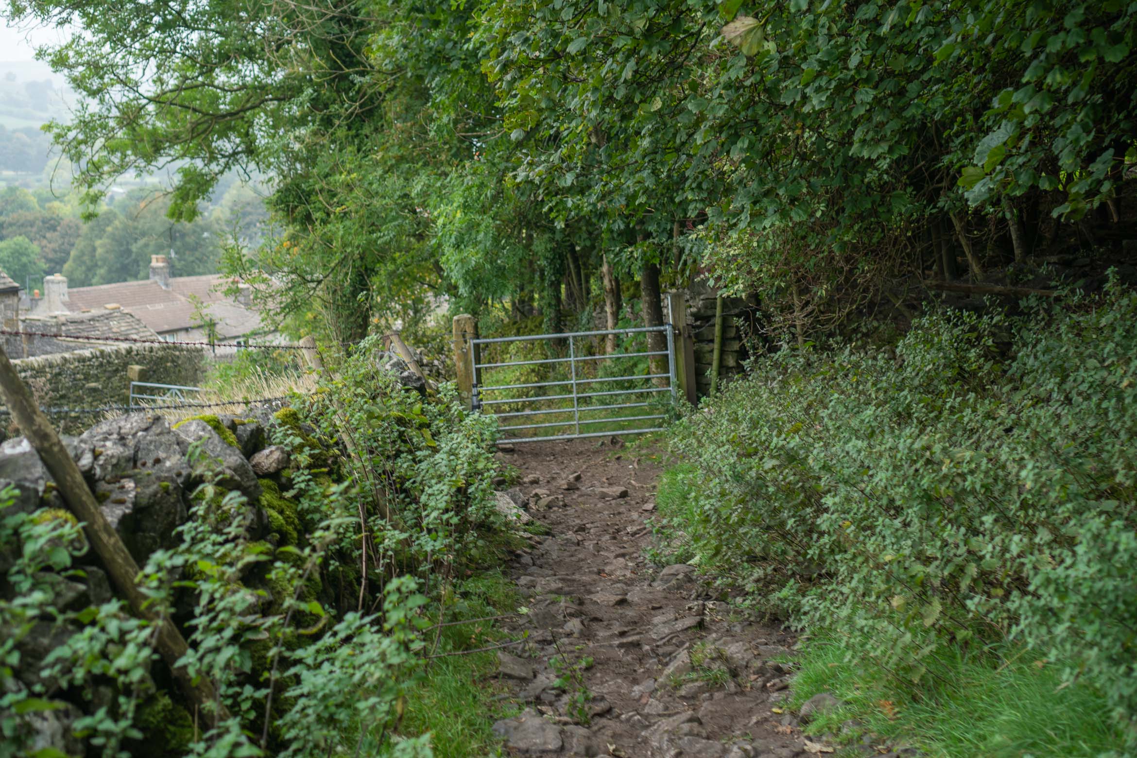
- It will eventually lead onto a small track. Turn right and you will see a metal gate. Go through the gate and downwards until you come out onto Goosehill Road. Follow this down, as it slowly bends to the right over a small bridge.
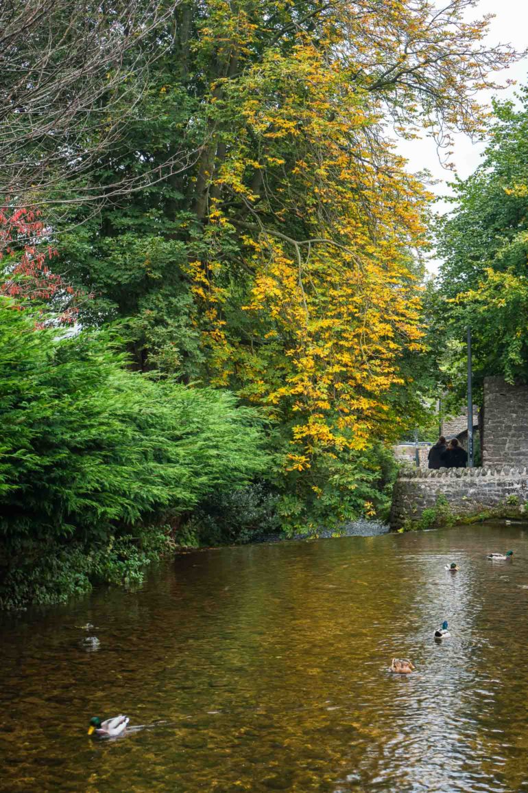
- Go across the bridge and follow the road around to the left. Keep to the left and turn on to the first path to your left, which will take you to a pretty stream. Then just follow this path alongside the stream to get back to the visitor centre.
I hope you enjoyed this walk, a perfect way to fill a morning or afternoon! Be sure to stop at the Three Roofs Cafe for delicious cake afterwards!
If you are looking for a longer walk you can do straight from Castleton, then try the Winnats Pass and Mam Tor hike.


 Things to do in London")

5 Comments
The scenery looks absolutely stunning. Thanks for sharing!
This walk looks seriously beautiful! The landscape is so lush! Thanks for sharing 🙂
It is my dream to hike in the Peak District one day. Your photos are gorgeous. So green.
thank you!
It looks like you had a lovely walk. The place is so serene and calm.